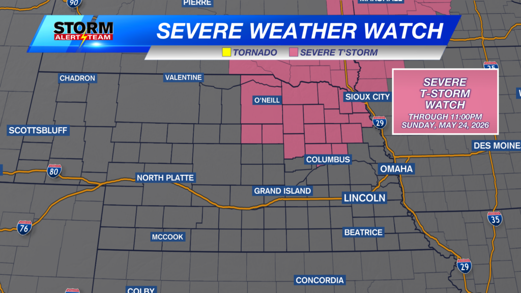
A SEVERE THUNDERSTORM WATCH is in place for parts of north central and northeast Nebraska through 11:00pm Sunday night. Hail, damaging wind, and a quick spin up tornado will be possible. Have a way to be alerted should storms pop up in your area tonight!
For up to the minute radar, go HERE.
For the latest warnings, go HERE.
For a live look at our Nebraska Weather Cams, go HERE.
And we would love to see video of any storm footage you may get (safely!). You can upload that using our Now Local News App HERE.
A line of storms will move from west to east across central Nebraska into eastern Nebraska through this evening. A few storms may become strong to severe.
Our StormCast weather model (above shows the potential for severe storms Sunday night, then again Monday afternoon.
Once again, a weak boundary later will push across the state on Monday giving the area highlighted above a chance for a few strong to severe storms.
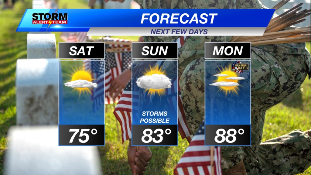
Memorial Day in Lincoln is looking sunny and warm. The storm chance will stay to the west and northwest for much of the day. If storms make it into eastern Nebraska, it would be later in the evening.
If you have pool plans, you’ll be just fine Monday and Tuesday. You may have to keep an eye on the radar Wednesday, though.
There will be more storm chances through the 2nd half of the week into the weekend. June looks to start off mild and sunny.
Chief Meteorologist Rusty Dawkins
Facebook: RustyWx
YouTube: RustyWx
TikTok: RustyWx
BlueSky: RustyWx
Instagram: RustyWx
Threads: RustyWx
Twitter: RustyWx
Categories: Channel 8 Eyewitness News Weather, Forecast
Tags: Beatrice, Broken Bow, channel-8-eyewitness-news-weather, Columbus, Crete, Fairbury, forecast, Grand Island, Hastings, Kearney, lincoln, lincoln forecast, Lincoln weather, McCook, Nebraska, nebraska weather, Ord, severe, seward, southeast nebraska, storms, weather, york