WEATHER ALERT FOR THURSDAY: We’re expecting a spring nor’easter to impact our area Thursday. Rain, some heavy, is expected Thursday along with strong wind gusts, especially along the south coasts of Rhode Island and Massachusetts. Minor beach erosion is also possible, along with localized street flooding.
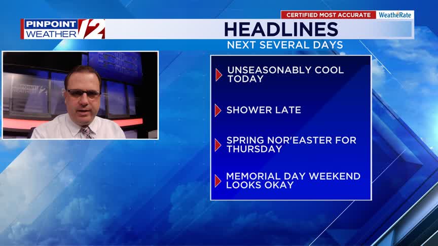
Good morning! Happy Wednesday! Today will be mostly dry, but quite chilly. That spring nor’easter impacts our area for Thursday with rain and wind. The Memorial Day weekend looks mostly okay.
INTERACTIVE RADAR: Live Pinpoint Weather 12 Radar »
| | FLIGHT TRACKER
| | POWER OUTAGES
TODAY
The average high temperature for this time of year is 70°. We’ll be 10 to 20° below average this afternoon with lots of clouds.
Hour by Hour // A close look at the upcoming conditions »
We may see a shower late in the afternoon across Rhode Island, maybe a sprinkle over Southeast Massachusetts, but most of the day will be dry.
With a northeasterly wind and the cloud cover, it’ll be tough to warm up. Highs will only be in the 50s.
| | BEACH AND BOATING FORECASTS
TONIGHT
Showers are possible this evening, but a widespread rain will start to move in later in the night and closer to dawn.
Lows tonight will be in the 40s.
TOMORROW
Widespread rain in the morning will become heavy at times.
That rain will continue through the afternoon and into the evening.
Here are the impacts: We’re expecting 1 to 2.5″ of rain through the day and that could lead to some localized street flooding. We’re watching the rivers closely, but they should be okay. Northeasterly gusts of 35-50mph are expected, the strongest near the south coasts of Rhode Island and Massachusetts, especially on the islands. Some minor coastal flooding is possible (mainly splashover) on the west bay of Rhode Island and along the South County coast. Minor beach erosion is also possible.
Highs tomorrow will still be unseasonably chilly….low to mid 50s.
That rain will continue through the afternoon and into the evening commute. The steadier rain should be winding down by around midnight.
LOOKING AHEAD
Friday will start out with some showers early on, but most of the day will likely be dry.
There will be lots of clouds around…a little sun. Highs Friday will be in the upper 50s to around 60.
-Meteorologist T.J. Del Santo
T.J. Del Santo (tdelsanto@wpri.com) is the weekday morning and noon meteorologist for 12 News. Connect with him on Facebook and Twitter and Instagram and Threads and BlueSky.
______________________________________________________________________________________________________
Pinpoint Weather 12 Links
Detailed 7-Day Forecast | Weather Now | Radar | Hour-by-Hour | Ocean, Bay & Beach | Pinpoint Traffic | Flight Tracker | Active Weather Alerts | Closings & Delays | Power Outages | Get the Weather App