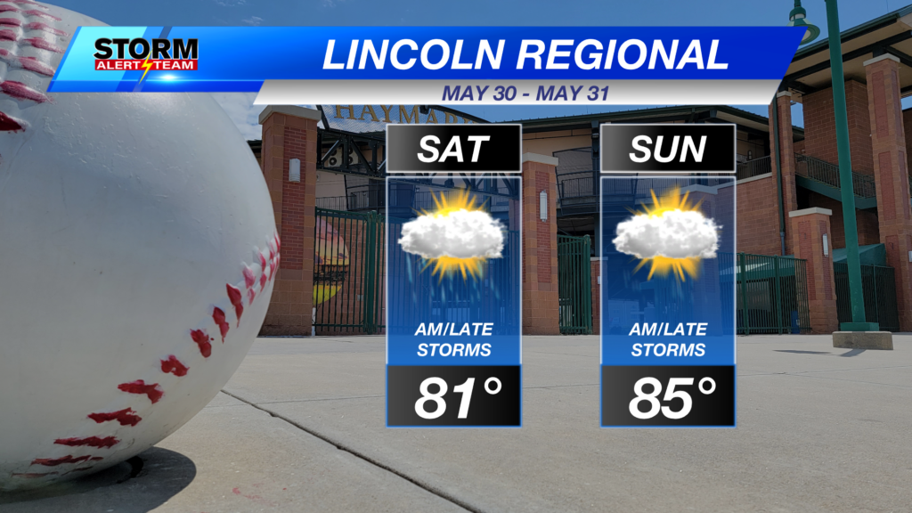
Severe storms are LIKELY Saturday evening into Sunday across Nebraska! Storms will develop out west near 4pm Saturday & move northeast through the overnight hours into Sunday morning. Lincoln and eastern Nebraska will likely see STRONG WINDS up to 55-65+ mph late Saturday night.
For up to the minute radar, go HERE.
For the latest warnings, go HERE.
For a live look at our Nebraska Weather Cams, go HERE.
And we would love to see video of any storm footage you may get (safely!). You can upload that using our Now Local News App HERE.
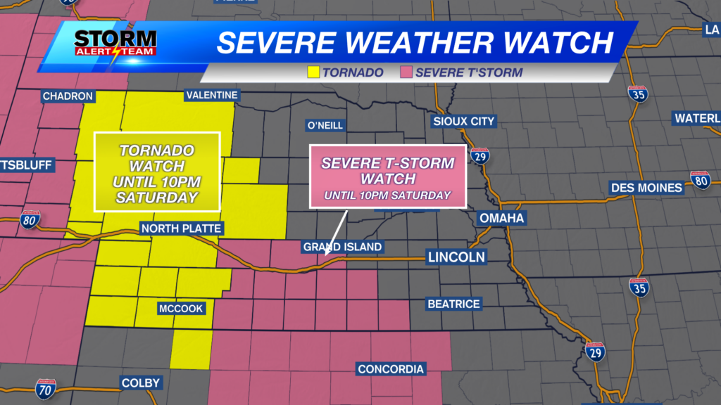
TORNADO & SEVERE T-STORM WATCHES are in place through 10pm tonight from Hastings and areas west.
FORECAST:
4-7PM: Isolated storms develop SW carrying a LARGE hail, tornado & wind threat. Storms will track north east through tonight. SW Nebraska will have the best potential for tornadoes this evening. Keeping an eye near McCook and areas near Broken Bow.
A few brief TORNADOES EF-1+ will be possible across SW and western Nebraska. I’m looking at places like McCook, Ogallala, Tryon, Mullen & areas north & west of North Platte .
5-8PM: Storm fuel Saturday evening will be high to extreme across SW Nebraska. The low level jet ( low level winds) will also be contributing this time. Those 2 combinations increase rotation within storms.
8-10PM: This will be when the wind & hail potential begin to peak. A few embedded tornadoes could be possible north of I-80 near Cherry county. Storms will push ENE as they converge. There could be rotation within this line of storms as they push up. Keeping an eye north of North Platte & areas slightly east.
Large hail up to golf balls or greater will be possible with these storms Saturday evening.
10PM-Midnight: Storms kick up into eastern Nebraska carrying a wind & hail threat. Lincoln will likely see storms near 9-11pm. Main concern across Lincoln and SE Nebraska will be damaging winds up to 65+ mph & small hail.
Damaging winds up to 65-75+ mph will be possible as storms push east into SE Nebraska by 11pm.
SUNDAY: MAY 31, 2026
High temperatures Sunday will reach the 80s and 90s. The hot spots near the NE/KS border.
Sunday evening near 5-11pm, a few strong to severe storms could pop up in SE Nebraska carrying a LARGE HAIL & wind threat. These storms will rely on Saturday nights storms. Stay tuned through Sunday for the latest. SE Nebraska will be the spot to watch Sunday evening,
Sunday 5-11pm: A few strong to severe storms could pop up in SE Nebraska carrying a LARGE HAIL & wind threat.
A HOT & muggy 10 day! This week brings rain/storm chances mainly into the evening hours with temperatures staying in the 80s and lows near 62-65 degrees.
Meteorologist Houston Hall
Facebook: HHallWX
YouTube: HHallWX
Tags: #klkntv, Beatrice, channel 8 weather, damaging wind, forecast, Grand Island, hail, Hastings, hot, lincoln, McCook, Nebraska, North Platte, Omaha, rain, severe weather, Spring, tornado, warm, weather, Wind