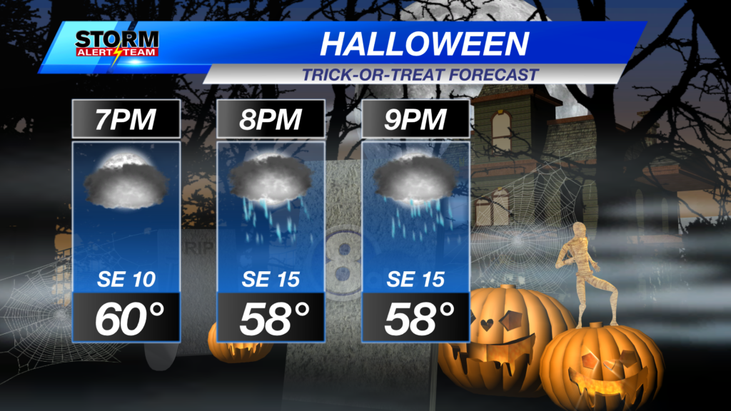
TRICK OR TREAT!? Tonight should be a TREAT. Expect Cloudy skies, steady temperatures & a little light rain/drizzle could be in store for Halloween tonight, especially farther west!.
A cool/warm & windy Sunday across Nebraska under cloudy skies! High temperatures statewide ranging from 55° – 73° with dew points in the 50s & 60s!
Sunday afternoon/evening, expect WINDY conditions to start up! SE wind gusts up to 35-45 mph across the state.
Monday, expect even WINDIER conditions ahead of the cold front. These winds will make conditions feel muggy & fuel T-storms by evening.
Monday morning looks to be a rainy & stormy one from W->E! No severe weather is expected in the morning hours.
MONDAY EVENING SEVERE WEATHER: Monday evening, a few storms could become severe as a strong LLJ moves through SE Nebraska.
Monday evening/night, a cold front moves W->E developing a few strong to severe storms in SE Nebraska. Stay tuned for the latest.
Rainfall through Tuesday looks decent across the state! Rain totals from 1.0″+ out west to 2-4″+ farther east! Keep an eye on the forecast through this weekend.
High temperatures look to stay near 57° – 64° through the next 10 days! *Morning temperatures look to cool near 33° – 43°! The BEST RAIN CHANCE arrives Monday & Tuesday. Much cooler air settles in late next week after the storm systems move out!
Meteorologist Houston Hall
Facebook: HHallWX
YouTube: HHallWX
Tags: #klkntv, Beatrice, channel 8 weather, cool, Fall, flooding, forecast, Grand Island, Hastings, High winds, lincoln, McCook, Nebraska, North Platte, Omaha, rain, severe weather, storms, warm, weather, Wind