
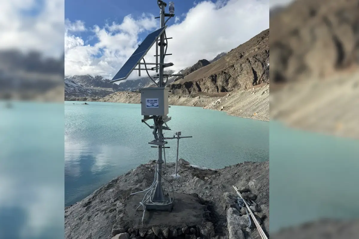
Dehradun, October 13, 2026: Uttarakhand has achieved a significant milestone in disaster preparedness with the successful completion of the first phase of an early warning system installation at Vasundhara Tal in Chamoli district. The system is designed to strengthen the monitoring of potential Glacial Lake Outburst Floods (GLOFs) and help authorities identify emerging risks in the high Himalayan region.
A scientific and technical team that undertook the challenging mission has returned after installing advanced sensors in and around the glacial lake. Secretary for Disaster Management and Rehabilitation Vinod Kumar Suman welcomed the team at the Uttarakhand State Disaster Management Authority (USDMA) on Tuesday.
The initiative was undertaken under the National Glacial Lake Outburst Flood Risk Mitigation Programme, following the directions of Chief Minister Pushkar Singh Dhami and Disaster Management and Rehabilitation Minister Madan Kaushik. Chief Secretary Anand Bardhan had flagged off the team on September 29.
CM Dhami calls it a major step towards disaster risk reduction
Chief Minister Pushkar Singh Dhami welcomed the successful completion of the first phase, stating that early identification of hazards associated with glacial lakes is crucial for a mountainous state like Uttarakhand.
He said the state government is strengthening disaster management through modern technology, scientific research and institutional coordination. The newly installed system is expected to improve risk monitoring, support timely warnings and enhance the safety of people living in vulnerable areas.
Disaster Management and Rehabilitation Minister Madan Kaushik described the initiative as an important achievement in glacial lake monitoring. He said the sensor-based system would provide valuable data on water levels, local weather, snow conditions and other natural changes, helping authorities assess potential risks and improve preparedness.
Chief Secretary Anand Bardhan also highlighted the importance of the initiative, noting that regular monitoring and scientific analysis of sensor data would help experts understand significant changes in the lake and its surrounding environment.
Advanced sensors to monitor multiple environmental parameters
The early warning system incorporates a range of advanced instruments designed to collect data on changing environmental conditions.
These include an all-in-one weather sensor to measure wind speed and direction, rainfall, solar radiation, air temperature and atmospheric pressure. Floating and submerged water-level sensors have also been installed to monitor changes in the lake’s water level.
Two accelerometers and tilt sensors will monitor vibrations, tilting and ground movements associated with potential flood activity. An additional accelerometer and tilt sensor have been installed to monitor avalanche-related activity.
The system also includes a snow-depth sensor, seven temperature sensors to measure temperatures at different depths beneath the snow surface, and a separate sensor to monitor the lake’s surface temperature.
The collected information is expected to help scientists identify unusual changes in water levels, weather patterns, snow conditions and ground activity.
Data to reach USDMA and CBRI dashboards every two hours
Under normal conditions, the sensors will transmit data every two hours to dashboards established at the Central Building Research Institute (CBRI) in Roorkee and USDMA in Uttarakhand.
In an emergency, the system can transmit data immediately without waiting for the regular two-hour reporting interval. This feature is intended to help authorities detect abnormal conditions more quickly.
Since Vasundhara Tal is located in a remote high-altitude area with no reliable conventional mobile network, the system uses Iridium satellite communication technology to transmit data.
Officials said the scientific team verified the communication system before returning, confirming that data was reaching the designated dashboards as expected.
Solar power system designed for remote Himalayan conditions
To ensure uninterrupted operation in the difficult terrain, the installation has been equipped with solar panels and battery backup.
According to the project details, the system has a 280-ampere-hour battery capable of providing approximately 10 days of backup when sufficient sunlight is unavailable. This arrangement is intended to keep the equipment operational during adverse weather conditions.
The equipment foundations have been developed using a modular steel design adapted to local conditions. Locally available stones have been used to reinforce the foundations, without the use of cement.
With wind speeds in the area estimated at 15–50 kmph, the foundations have been designed to withstand wind speeds of up to 100 kmph.
Vasundhara Tal measures nearly 38.5 metres in depth
Dr D.P. Kanungo, a scientist at CBRI Roorkee and the leader of the expedition, said Vasundhara Tal is approximately 38.50 metres deep, 600 metres wide and 900 metres long.
He said the team tested the sensors and communication system and verified the exchange of data during the mission. A comparison of earlier records with the current situation indicated no significant change in the lake’s dimensions, according to the project team.
The installation locations were selected after considering potential landslide and avalanche risks, local weather conditions and the safety of the equipment.
Multi-agency coordination supported the mission
The expedition was carried out with the participation of scientists and technical experts from CBRI Roorkee and the Wadia Institute of Himalayan Geology in Dehradun.
USDMA coordinated the operation and provided logistical support and communication equipment. The State Disaster Response Force (SDRF), National Disaster Response Force (NDRF) and Indo-Tibetan Border Police (ITBP) also played important roles in supporting the mission.
Officials said the successful installation marks an important step towards strengthening scientific monitoring of glacial lakes in Uttarakhand. The data generated by the system is expected to support risk assessment, improve preparedness and help authorities respond more effectively to potential hazards in the Himalayan region.
The first phase of the Vasundhara Tal project establishes a technology-based monitoring mechanism in a challenging high-altitude environment, with the broader objective of reducing disaster risks and protecting vulnerable communities.