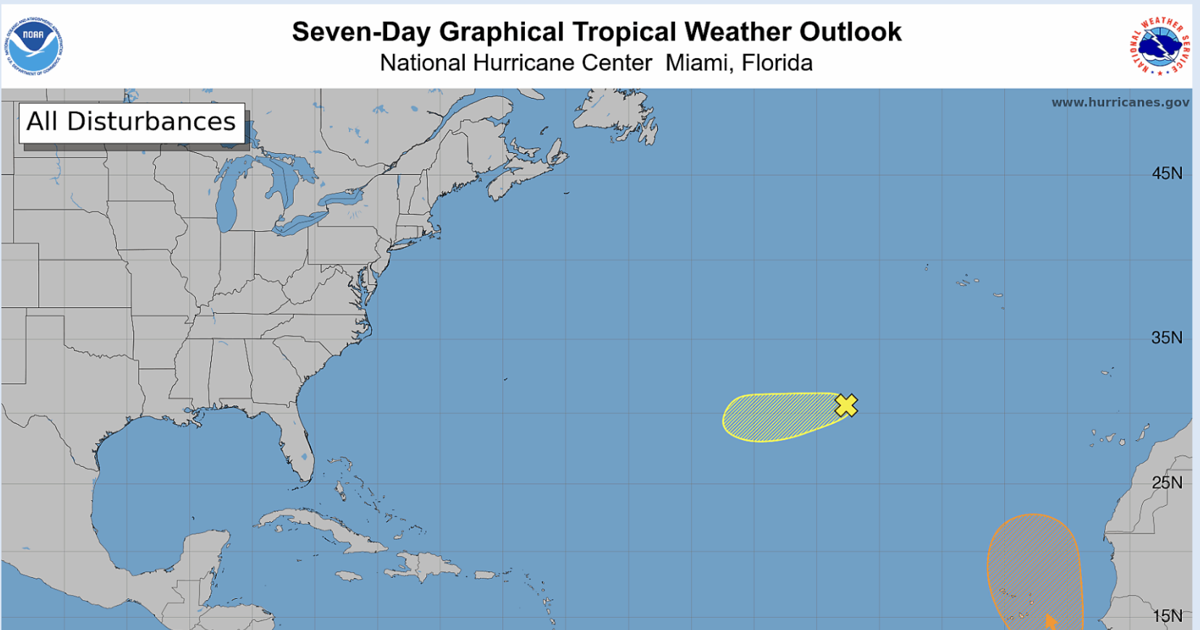
A tropical disturbance that moved off the west coast of Africa Wednesday morning may develop into a tropical depression late this week, forecasters with the National Hurricane Center said.
The area of low pressure, located 600 miles southeast of the Cabo Verde Islands, is expected to organize in the next day or two and possibly become a tropical depression by Thursday or Friday as it moves northwest to north. As of 7 a.m. Wednesday, forecasters gave the system a 40% chance of developing in the next week.
However, the system is expected to face strong upper-level winds this weekend that are likely to prevent any additional development, NHC forecaster John Cangialosi said.
There is currently no expected threat to Louisiana.
Interests in the Cabo Verde Islands should be on the lookout for potential gusty winds and areas of heavy rain late this week.
If the system were to become a named storm, it would be Gonzalo.
Fay’s remnants
The remnants of Tropical Storm Fay were about 800 miles southwest of the Azores on Wednesday morning.
Though it was still producing showers, redevelopment is unlikely as it moves west and faces unfavorable weather conditions.
Forecasters give the system a low 20% chance of forming over the next seven days.
The 2026 hurricane season was the first time in the modern satellite era that the Atlantic has not had a hurricane form this late into September. Powerful El Niño conditions have kept the 2026 Atlantic hurricane season quiet, with only six named storms so far.