Hot springs and fairy-tale lakes are true treasures of Tajik nature. In the Gorno-Badakhshan Autonomous Region, among high mountains, there are bodies of water with an unusual history and mysterious phenomena. We tell you about the lakes of the Pamir, which amaze with their beauty and uniqueness.
The Pamir is quite rich in a variety of picturesque bodies of water, distinguished by color, water composition, and formation method. Flow-through lakes are fed by meltwater and spring water and contain significant volumes of fresh water.
Closed-basin lakes are fed only by precipitation and melted ice, have a seasonal character, and often change their outlines.
There are few large lakes in the Pamir, but several relatively large ones deserve special attention. They are known not for their size, but for their uniqueness, beauty, and the number of legends and phenomena that attract the attention of travelers, researchers, and local historians. However, for local residents and animals, these places are home and natural sources of existence in extremely harsh climatic conditions.
Karakul
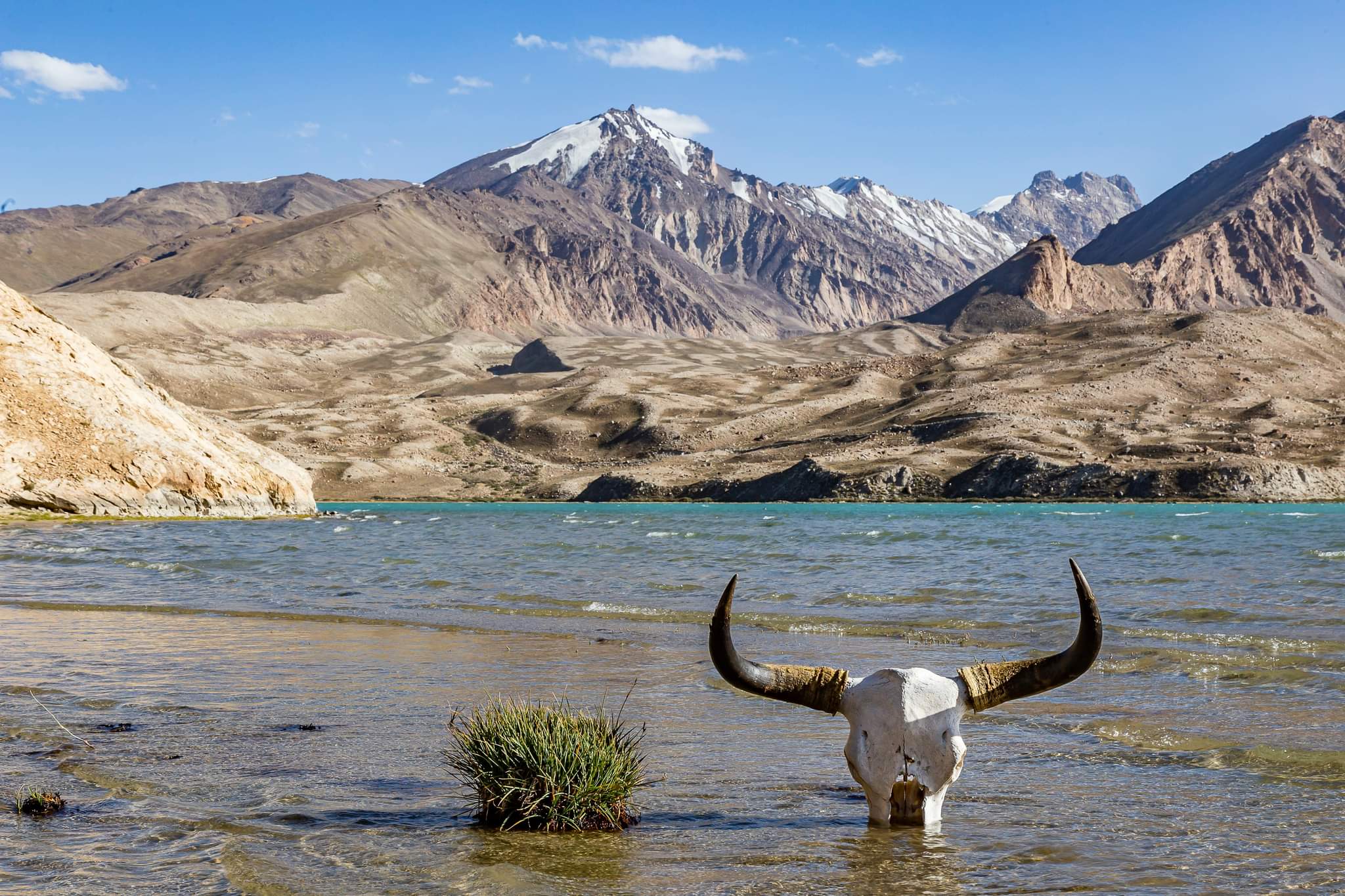
Near the border with China, in the dry, almost uninhabited and desert part of northeastern Pamir, where the least precipitation falls, at an altitude of about 3,995 m above sea level, lies the largest body of water in Tajikistan – the completely closed-basin lake Karakul (“black lake”).
The crystal-clear water surface of the lake shimmers with blue-green hues. It becomes black only during strong winds that carry fine sand and clay particles across its surface. Its shores are saline, and the water in the lake is bitter-salty and has increased density.
In good weather, its transparency reaches 9 meters.
The surface area is 380 square kilometers. The greatest recorded length is 33 km, and the width is 24 km. The maximum depth is 236 meters. On the western side, rocky mountains adjoin the lake closely.
The age of the youngest rock samples taken from the shores reaches 230-190 million years.
According to a recent version by scientists, Lake Karakul was formed as a result of a large meteorite impact approximately 25 million years ago.
This conclusion was made based on modern satellite images, but not everyone agrees with it. Some scientists believe that this intermountain depression is a consequence of tectonic processes.
The shores of the body of water are covered with ice year-round, which lies even on the bottom. The thickness of ice in winter reaches one meter, and due to its active melting, the outlines and size of the lake constantly change.
Scientists still have no unified opinion about the origin of this ice. It is quite possible that these are remnants of an ice sheet that filled the basin during the last ice age.
The rivers Muzkol, Karadjilga, Akdjilga, and Kararat flow into the lake. Fish are found near their fresh mouths.
The main flora of the shoreline consists of desert grasses and thorns. Less common are sedge, wormwood, Pamir buckwheat, and salt bushes. The fauna is represented by colonies of geese and gulls that have taken over the islands. Other seasonal representatives of the local fauna are karakurts and the wasps that feed on them.
There was also a rumor about a fish-like creature of great length, which, allegedly, was observed several times through binoculars by border guards. Swimming along the shore, the monster churned up foam on the water, and after diving, it emitted a strange low sound, audible within a radius of hundreds of meters.
Near the eastern shore, there is a kishlak of herders with a population of 500-600 people. In summer, they graze livestock, and by autumn, part of their herds are slaughtered due to the inability to store feed for winter. So some shepherds who grazed herds near the lake also tell of some creature living in the waters. Allegedly, it sometimes swims along the shore, curiously observing people.
However, the descriptions differ somewhat. Some saw a huge fish, others claim it is a giant snake. Still others speak of a horned creature with a head resembling that of a bull. Their accounts agree on one thing: when it appears, strange sounds are heard, resembling a low-frequency roar.
Special searches for the creature have never been conducted, and there is no documented evidence of this phenomenon yet.
By the way, a kilometer from the kishlak is an ancient architectural complex built in the middle of the 1st millennium of our era. The complex represents an observatory and a sanctuary erected in honor of animals.
And several kilometers north of the lake, in a completely lifeless valley covered with large pebbles, of the Markansou River, expeditions led by the famous archaeologist V. Ranov discovered the now-famous Mesolithic-era ancient human settlement of Oskhona.
No similar settlements at such an altitude have been found anywhere in the world. The dating places it in the 7th millennium BCE. Thanks to excavations, it became clear that the basis of the life activity of these ancient people was seasonal hunting and gathering. Apparently, at that time the climate of the region was not so harsh.
And subsequent changes may be a consequence of some global geophysical processes or natural uplift of the tectonic plate.
However, it is evident that at some point, the Pamir Plateau was covered by enormous bodies of water and green valleys with rich flora and fauna.
Sarez
In the winter of 1911, a water surge rose on Lake Karakul. Tearing off an ice cover one and a half meters thick and scattering it within a radius of two kilometers, the rushing torrent rapidly flooded the low-lying shores.
At the same time, around midnight on February 18, the foot of the Muzkol ridge, at the narrowest point of the Murgab River valley, suddenly collapsed, exposing the mountain’s interior. A colossal landslide completely buried the kishlak of Usoi that was located there, destroying all life.
The giant debris blocked the flow of the Murgab River and the Shadadarya River that flowed into it. On the opposite side of the ridge in the Kudara River valley, many yurts were destroyed, about 40 people died, and west of the kishlak of Pasor, a large hanging glacier broke off from the ridge, blocking the river.
The force of the collapse near Usoi was so great that small stones scattered 10-15 km around, and huge boulders weighing several tons were thrown 3-4 km away.
The height of the debris reached 700 m, and the width was almost 3 km. Only three residents who were outside Usoi survived. Together with residents of neighboring kishlaks, they observed for several days a huge curtain of dust and heard the roar of continuing rockfalls at the site of the catastrophe.
Water began to accumulate at the debris, and its level rose rapidly at approximately 36 cm per day. By the end of the year, water had already reached the higher kishlak of Sarez, and its residents were forced to abandon their homeland, relocating to the Gunt and Kudara valleys.
After the flood, a closed-basin body of water began to form. In the summer of 1913, the lake was visited by an expedition led by the commander of the Pamir detachment, Lieutenant Colonel G. Shpilko. After taking measurements, they noted that the length of the lake reached 28 km, and the depth was 280 m.
A few months later, two more kishlaks were flooded: Nisordashт, which stood upstream on the Murgab, and Irkht, which was located near the dam. The residents of these settlements moved to the Bartang valley.
In 1914, a local resident, Kabul Kurbonbekov, left by Shpilko to observe the lake, noticed that spring water began to seep through a kilometer-thick layer of debris. Emerging from it 150 m below the lake level, these waters quickly turned into a raging stream carrying a huge amount of large stones.
A real threat of dam failure arose, which would have caused an unprecedented flood. But nature proved favorable, and destruction did not occur.
Until 1946, the water level in Sarez rose in jumps, until it stabilized around 1960 at a mark of about 500 meters, with a volume of 16-18 cubic kilometers. The length of the lake along the gorge varied from 65 to 75 km in different years.
In 1947, the head of the Irkht weather station, V. Akulov, expressed an opinion based on measurements that the growing canyon from the lake side, upon reaching dolomite deposits, would accelerate the destruction of the Usoi debris dam. And already in 1948, a forecast was published that the dam would be completely eroded within 20 years.
As is known, the forecasts did not come true, and in the early 1970s, the Soyuzvodproekt institute began developing a plan to build a diversion tunnel to create a hydroelectric power station. It was assumed that the water level in the lake would be lowered by 100 m, which would eliminate the possibility of a breakthrough, provide electricity for the development of Pamir infrastructure, and provide a supply of fresh water for Central Asia.
In the scientific world, the causes of the catastrophe were debated for almost half a century. Everyone was interested in the question – what caused such a colossal collapse?
Some believed that the cause was the instability of the slope, whose enormous masses, striking the ground, caused seismic activity. Others were convinced that the collapse occurred as a result of a powerful underground tremor.
However, the point in this question was settled by data that surfaced from the seismograph of the Pulkovo Observatory, which recorded echoes of a major earthquake with an intensity of 9 points and ground displacement of 100 microns.
There were no witnesses to the catastrophe as such; everyone was buried under the debris. The first people were able to reach the site of the catastrophe only a month later. And the first examination of the debris was conducted almost a year after the event by German geologist Arved Schultz. In fact, his examination marked the beginning of the study of Sarez and the advancement of hypotheses about the cause of the catastrophe.
In recent decades, even enthusiasts of the exotic have come up with their own version, claiming that the collapse occurred as a result of a meteorite or UFO impact. Although rumors of UFOs in the Pamir are not uncommon, the impassability of these places and the distance in time do not allow this version to be verified.
Scientists studying Sarez are more concerned with the problem of the debris dam, since one or another significant natural factor could lead to a major and inevitable catastrophe.
Currently, Lake Sarez is located at an altitude of 3,239 m above sea level, its area is 86.5 square kilometers, the maximum depth is 500 m, and the width is 3-4 km. The volume of fresh water is 17 cubic kilometers, distinguished by exceptional purity and transparency.
The lake is fabulously beautiful; in the mirror of its surface are reflected the sides of the valley and the snow-capped peaks of the Muzkol ridge. Its shores are sheer cliffs or active scree slopes descending directly into the water. It is impossible to move along the lake on land. Movement on water is limited by constant westerly winds and waves of 4 points.
The frequency of earthquakes in this seismically active zone with a magnitude of 8-9 points is quite high – once every 250 years, according to other data – once every 2,000 years, and at 7 points – once every 100 years.
Most specialists from the beginning of research have been inclined to believe that the debris dam is stable and, in the absence of external impact, will stand for many more thousands of years. But there were also scientists in different years who expressed concerns that the assessment of the dam’s strength was exaggerated.
At the same time, it is well known that the Usoi debris dam is not the first lake-forming one in this valley: the previous 9 debris dams that formed during the Quaternary period were destroyed.
No similar debris dams have been recorded anywhere else in the world during our historical period.
But what is important is that the location of these debris dams in one limited area indicates ongoing tectonic processes and a very turbulent life of the Muzkol ridge over several thousand years.
In the event of another cataclysm, the dam could be destroyed, leading to a colossal flood that would destroy all populated areas and infrastructure in the Amu Darya River basin, over a territory more than 2,000 km long.
In 1994, as a result of a record flood, the estimated water level in the lake rose by 3 meters, but nature proved favorable once again.
Yashilkul
40 km south of Sarez, in a valley carved by an ancient glacier of the Alichur River, at an altitude of 3,734 m above sea level, lies the picturesque, flow-through lake Yashilkul (Green Lake). Its length is 18.6 km, and its width ranges from 1 to 4 km, with a maximum depth of 52 m.
The water in the body of water is fresh and transparent, and the temperature never exceeds 14 degrees Celsius. The shores of the lake are in places swampy and covered with sedge. In shallow water among the stones, algal shoots grow. There are many small bays and semi-enclosed lagoons with sandy bottoms.
The lake first appeared on geographical maps in 1760. But it is quite obvious that it existed before this time, and according to scientists, it was formed in prehistoric times as a result of a rock collapse along the left bank of the river.
The debris dam, with a thickness of 110 m, stretched across the valley for more than 4 km. The probability of dam failure is low, as its bottom is firmly silted. Overflowing the southern edge of the dam, the water passes through numerous small waterfalls, and gradually collecting into one channel, forms the Gunt River.
Near the lake is the Akdjar tract, covered with yellow sandy-pebble hills and granite fragments. Once these masses were brought by the Alichur Glacier during the melting period from the upper reaches and middle course of the present-day river.
Water and wind transformed granite boulders and blocks into stone sculptures, giving them whimsical zoomorphic forms.
But there is also a small freshwater lake called Bulunkul in the gorge, located slightly south of the mouth of Yashilkul and connected to it by a narrow channel. Bulunkul has abundant aquatic vegetation and is favored by ducks, geese, and flocks of gulls darting about. The fish species found there include the Amu Darya marinka and marinka.
Notably, this lake was the site of the first fishing industry organized on the Pamir. Nearby is a cemetery of Pamir Kyrgyz and the only kishlak of Bulunkul in the entire area.
Once, the only state farm in the USSR for yak breeding was located here. Now, only about two dozen yurts remain from the state farm, where herders still live, and the pitiful ruins of nondescript structures.
The lowest winter temperature in Central Asia has been recorded in this region – minus 63 degrees Celsius.
From the north, the granite slopes of the Bazardara Ridge closely approach Lake Yashilkul, leaving a narrow strip of shore only a few meters wide for passage. Moving along this shore toward the rockfall, one can reach a semi-abandoned ancient trail laid with worn flat stone slabs.
Geologists V. Loskutov and O. Chedia discovered a granite boulder here measuring 10 by 4 meters, with Arabic inscriptions carved on it. The inscription, deciphered by Dushanbe philologist V. Demchik, has approximately the following content: – “…in honor of the Almighty, a road was built by Emir Ahmed, son of Sultan Tekin, in the year 509 from the flight of the Messenger of Allah, may peace be upon him”.
Converted to the modern calendar, the inscription is dated to 1193-1194 AD.
The fact that the area around Lake Yashilkul has been visited by people since ancient times is also evidenced by a sacred site located near the mouth of the Alichur River and surrounded by partially ruined mausoleums. This is the hot hydrogen sulfide spring Issykbulak. The water temperature in it is 71 degrees Celsius, and it consists of four springs scattered along the base of a granite massif.
The abundance of traces of extinct springs speaks to the longevity of this system’s existence.
The renowned geographer N. Korzhenevsky, who visited these places in 1923, recorded a very curious legend from local residents associated with a small, hook-shaped peninsula – “Kampirchik” on the northern shore of Lake Yashilkul:
“
Three hundred years ago, in the place of the present-day lake, there stood a large and prosperous kishlak. One evening, a weary wanderer came there and asked for shelter and food. But no matter how many courtyards he visited, no one would let him in. Finally, he knocked on the last, poorest house. Here, a lonely old woman took him in and fed him, cooking her last chicken. Early in the morning, the wanderer got up and said to her: “Kampirchik, leave here for the mountain immediately.”
She obeyed and did as he said. As soon as she climbed onto the rocks, the earth shook terribly and water rushed in, swallowing the village with all its inhabitants.
It is worth mentioning another widespread legend about a huge animal living in the lake, called Tyuya-su by the Kyrgyz people – the “water camel.” We find these accounts both in the Chinese traveler Xuanzang, who visited there in the 7th century AD, and in modern ethnographers M. Andreev and A. Stanishevsky. However, these accounts have not been verified or confirmed to this day.
Verification of such information requires complete 3D scanning of the bottom. But if such scanning is to be done, it would be better to conduct it in the zone of dangerous natural dams, with the aim of predicting tragic floods. And let the purest lakes of the Pamir continue to delight the human eye for a very long time, and in the age of high technology, new generations will have the opportunity to organize their reliable protection and preserve them from pollution.