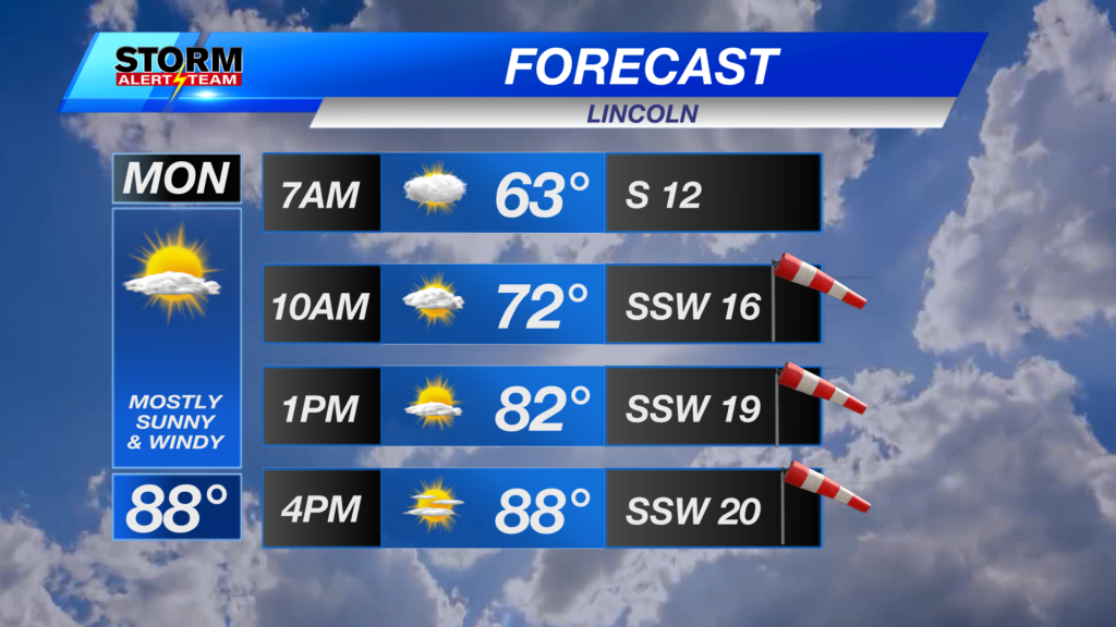
Another HOT, breezy & mostly sunny day across SE Nebraska! State highs will reach the 60s, 70s & 80s with a SW breeze 10-15+ mph. Critical fire weather will occur across our southern counties, where a crucial stationary front will lay. This front will determine our storm chances this evening.
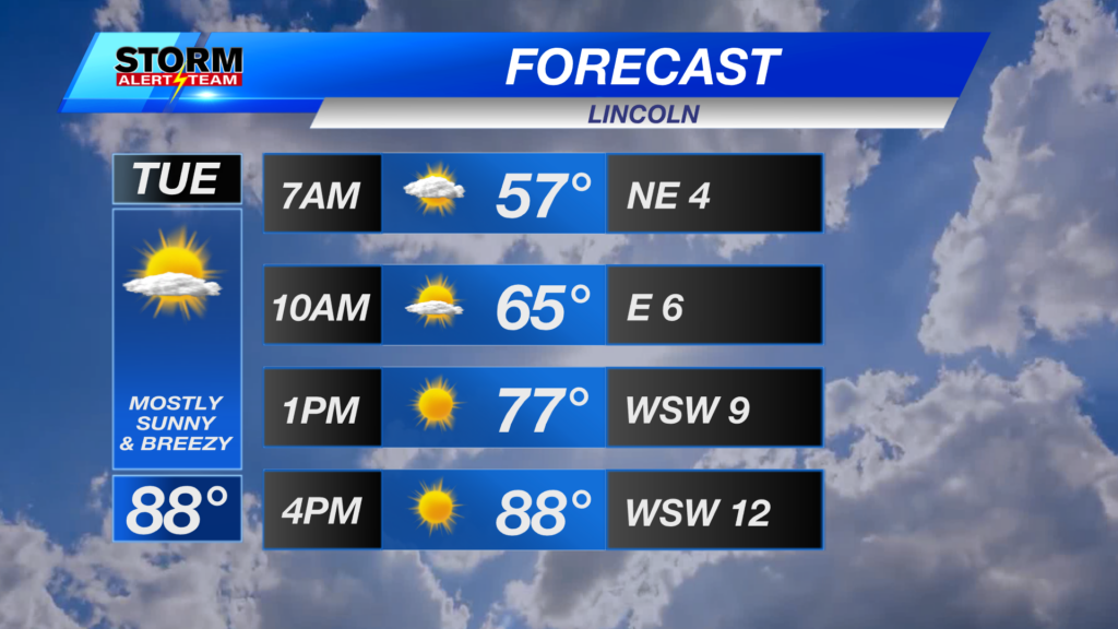
High temperatures this afternoon reaching the 60s, 70s & 80s! The hot spots will be south of I-80. Cloud cover keeps temperatures cooler out west.
Large hail will be the main concern with any storms tonight in SE Nebraska. The main timing will be from 9pm-1am Wednesday morning.
The main threat for severe weather will be from 9pm-2am Wednesday morning. Isolated storms could produce small to large hail along a moist boundary.
Far SE Nebraska will likely see some lingering T-storms through midnight tonight.
SE Nebraska, keep an eye out for Friday afternoon and evening! A strong cold front will push through bringing a decent chance for strong to severe storms with all hazards possible.
A few strong storms possible Tuesday night from 7pm -midnight across SE Nebraska. Large hail being the concern. A hot and sunny Thursday. SE Nebraska, keep an eye out for Friday afternoon and evening! A strong cold front will push through bringing a decent chance for strong to severe storms with all hazards possible. A beautiful weekend with cooler temperatures and less humidity!
Meteorologist Houston Hall
Facebook: HHallWX
YouTube: HHallWX
Tags: #klkntv, Beatrice, breezy, channel 8 weather, cool, forecast, Grand Island, hail, Hastings, High Fire Danger, lincoln, McCook, Nebraska, North Platte, Omaha, rain, red flag warning, severe weather, Spring, thunderstorms, warm, weather, Wind