GRAND RAPIDS, Mich. (WOOD) — A major winter storm will push West Michigan back to winter for the next few days.
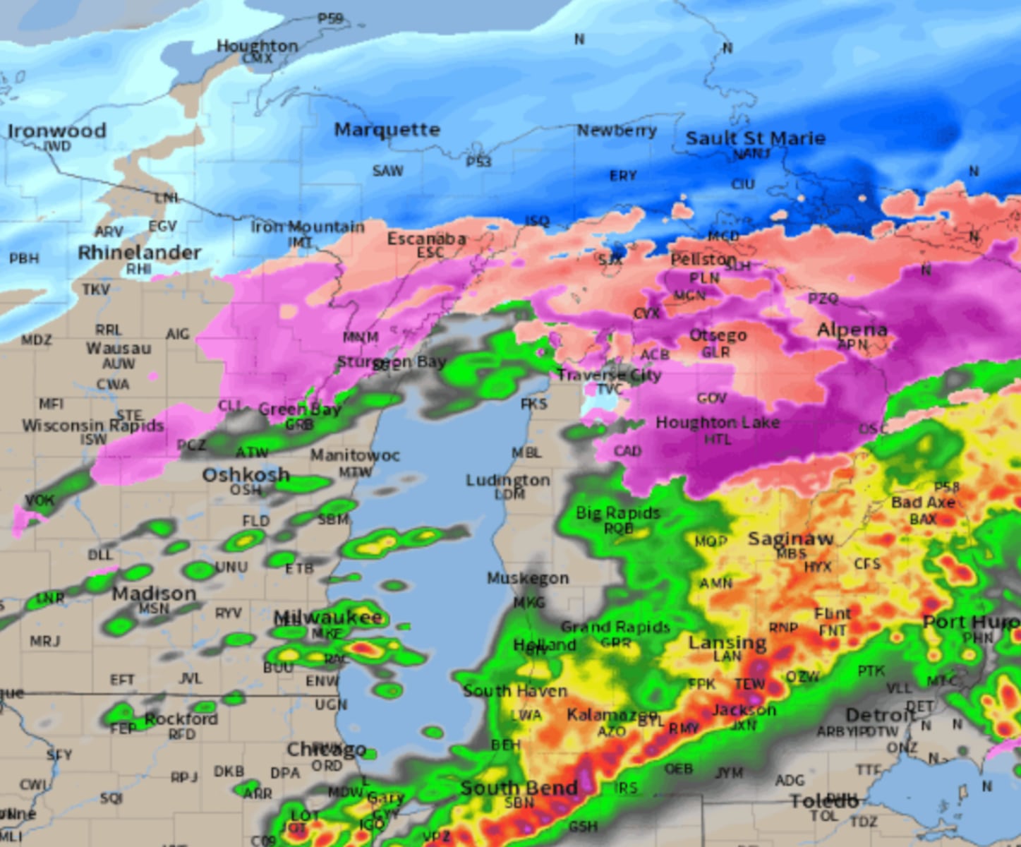
As the deep area of low pressure exits Michigan, strong northerly winds will draw in much colder air with intensifying snow showers. This is the same storm system that has deposited 1-3 feet of snow across the Upper Peninsula and the Straits area.
Northern Michigan hit with power outages as winter storm continues
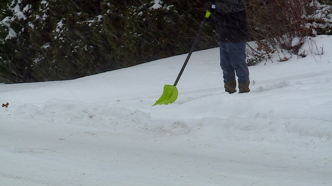
Snow showers will intensify throughout the day Monday with accumulating snow likely.
How much snow you receive will depend on your location. There will be a lake-effect component to it, so lakeshore areas will receive the most. If you live in and around Grand Rapids, you will not have to shovel as much.
The snow will be accompanied by strong winds that will gust to nearly 50 mph. This will reduce visibility for drivers, creating a challenging afternoon and evening commute. Some of the most difficult travel will be along I-196 and US-31 near the lakeshore. US-131 north and south of Grand Rapids will also have its issues.
The third part of the equation will be the return of much colder temperatures. Hopefully you brought or wore your winter jacket Monday, as it will be much colder when you return from work or school. Temperatures will fall into the 20s, with wind chills crashing to 5 to 10 degrees above zero by sunset.
The cold air will peak on St. Patrick’s Day, with highs running 20 degrees below average. If you are celebrating, expect temperatures to peak in the low to mid-20s Tuesday as wind chills remain in the single digits most of the day.
Temperatures will begin to warm up as the coldest air returns to Canada later in the week.
Download the free Storm Team 8 weather app
This will help temperatures to achieve readings closer to average and maybe even a little above at times. This will also help melt the snow.
Stay with Storm Team 8 for the latest.