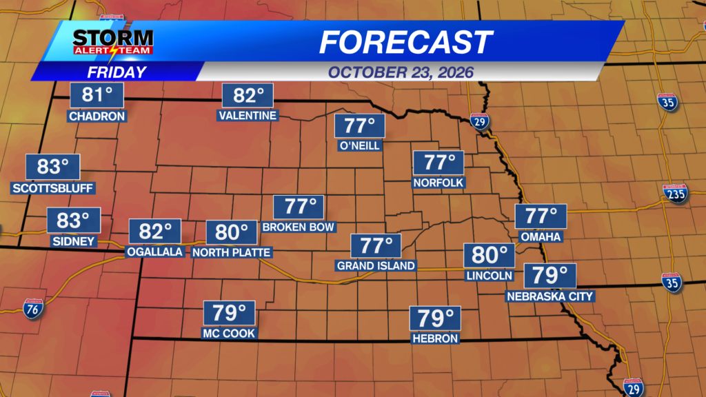
A WINDY & WARM day under mostly/partly sunny skies across Nebraska! High temperatures statewide ranging from 80° – 88° with dew points in the 40s & 50s!
South winds will gust to near 25-35+ mph across much of Nebraska today! Cold front will bring north winds Saturday afternoon & evening!
Saturday morning, a line of showers/T-storms will develop from the Tri-Cities & areas N & West. SE Nebraska will stay dry through Sunday evening.
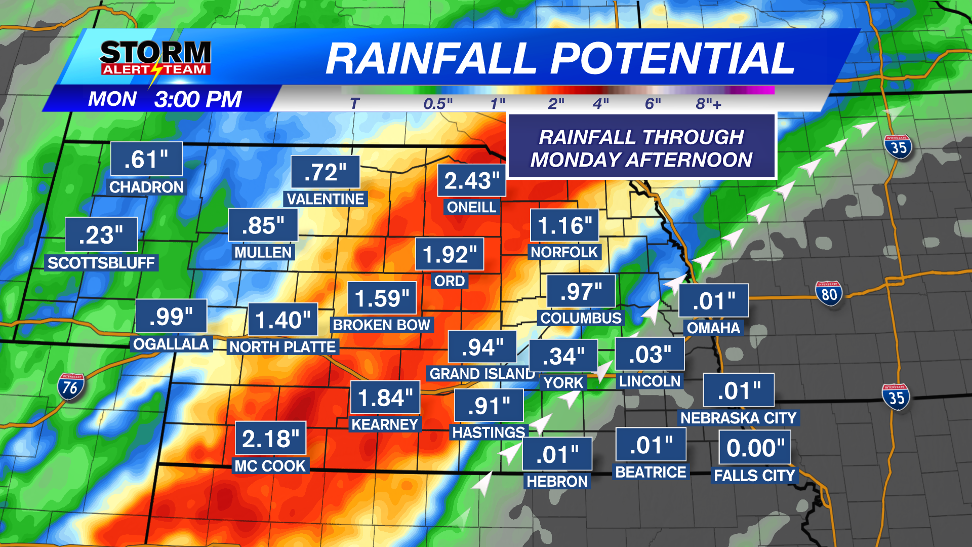
Rainfall through Monday looks very prominent for areas west of Lincoln & Omaha! Areas of 2-3″ of rain will occur from SW->NE.
The main reason SE Nebraska will miss out on the rain will be due to ridging! The best moisture will go over the HIGH PRESSURE like past events.
High temperatures look to stay near 62° – 78° through the next 10 days! *Morning temperatures look to cool near 37° – 45°! The BEST RAIN CHANCE arrives Sunday night- Monday & Tuesday. Much cooler air settles in next week, with a few potential storm systems near HALLOWEEN & into November! Stay tuned for the latest.
Meteorologist Houston Hall
Facebook: HHallWX
YouTube: HHallWX
Tags: #klkntv, Beatrice, channel 8 weather, cool, Fall, forecast, Grand Island, Hastings, lincoln, McCook, Nebraska, North Platte, Omaha, rain, thunderstorms, warm, weather, Wind