INDIANAPOLIS (WISH) — We have another stretch of active and changing weather ahead, featuring strong winds, showers, and storms, followed by a sharp blast of much colder air by next week.
Cooler but seasonable Thursday:
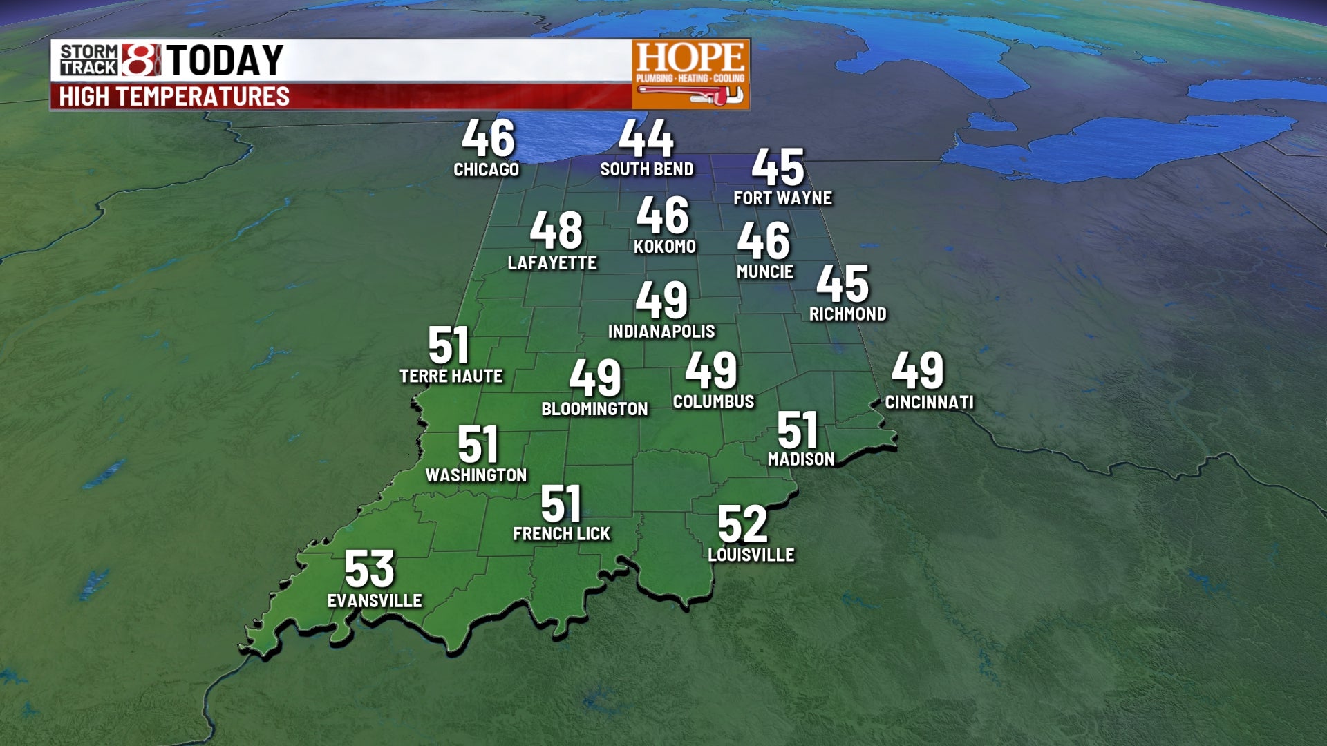
We are significantly colder across the area this Thursday morning. With temperatures in the 30s, we are running anywhere from 30 to 40° colder than Wednesday morning.
Despite the cooldown, today will be quite seasonable for mid-March. Look for sunny skies, calm conditions, and near-average temperatures, with highs reaching the upper 40s and lower 50s this afternoon.
Wind Advisory for Friday
A wind advisory is in effect from 5 AM to 8 PM Friday across much of central Indiana as another powerful weather system moves across the northern Great Lakes. A strong low-pressure system will track well north of the state but will create a very tight pressure gradient, allowing strong winds for much of the day. Wind gusts are expected between 40 and 45 mph, with some northern counties seeing gusts over 50 mph.
The winds will likely be at their strongest in the morning and will gradually diminish heading into the afternoon hours.
While this system remains well north of our state, we could still see a few isolated light showers in the northern portions of the state during the day on Thursday.
Most areas will stay dry and warmer, with high temperatures climbing into the mid and upper 50s.
Quiet Weather Returns Saturday
High pressure will briefly bring calmer conditions to start the weekend on Saturday. Temperatures will be a bit cooler but seasonable for this time of year, with highs in the low to mid 50s.
Storms Return Sunday
Our next weather system of interest will move in late in the weekend, bringing showers and thunderstorms back to the forecast Sunday night into Monday.
Temperatures ahead of the system will jump into the mid to upper 60s, with the possibility of even 70° readings for parts of the state.
A cold front marching through Sunday night will trigger scattered showers and thunderstorms. At this time, widespread severe weather does not appear likely, but an isolated strong storm or two cannot be ruled out Sunday afternoon and evening.
There will be a threat of heavy rain at times, and with saturated ground and ongoing river flooding, this will continue our flooding concerns early next week.
Major Temperature Drop Early Next Week
Behind Sunday’s storm system, much colder temperatures will surge into the state. The snap will be significant—expect temperatures to drop more than 30° Sunday night into Monday morning. High temperatures will struggle to even reach the freezing mark on Monday. With very gusty winds continuing as the system moves out, it will feel significantly colder. In addition, some light snow showers are possible through the day on Monday, though little to no accumulation is expected.
St. Patrick’s Day on Tuesday doesn’t look much better, with temperatures likely failing to reach the freezing mark during Tuesday afternoon.
The longer-range pattern shows us climbing the ladder by the middle and end of next week, with 40s likely on Wednesday. Beyond the seven-day forecast, we’re seeing temperatures climb back into the 50s and 60s as we head into the following weekend.