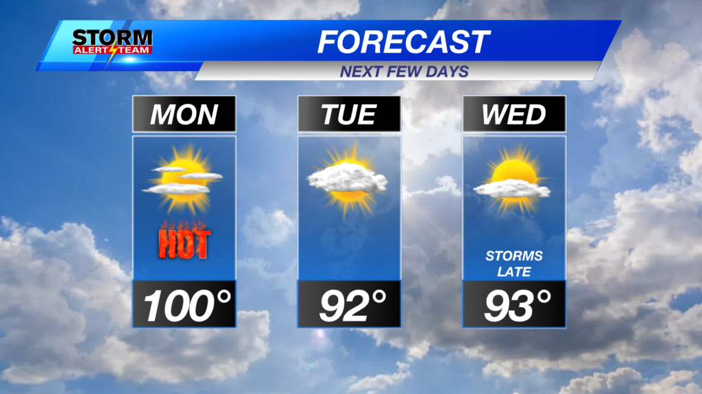
One more day of temperatures near the triple digits on Monday, with a cold front taking a few degrees off our high temperatures for the middle of the week.
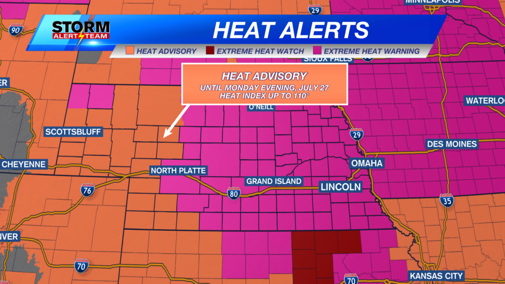
Heat alerts remain in place across the state, with an Extreme Heat Warning in place for eastern Nebraska until 9 p.m. CDT Sunday, in southeast Nebraska, and 7 a.m. on Monday, in northeast Nebraska.
A Heat Advisory will remain in place for southeast Nebraska until 10 p.m. CDT on Monday, July 26. Afternoon feels-like temperatures up to 110 degrees are possible for the start of the work week.
Outside of the heat, there is a conditional risk for strong to severe storms in eastern Nebraska. A Slight Risk (Level 2 out of 5) is in place for northeast Nebraska, where scattered severe storms are possible on Sunday evening. Large hail and damaging winds are the main concern if storms develop.
Here is a look at the latest run of StormCast, showing the potential timing for storms on Sunday night if they can form. Keep an eye out for a few showers and thunderstorms on Monday as well along the incoming cold front.
An isolated severe storm or two will also be possible on Monday afternoon for the panhandle and southwest Nebraska. A Marginal Risk (Level 1 out of 5) of severe weather is in place, with damaging winds the main concern for these storms.
By early Monday morning, many of us will still see temperatures in the mid-to-upper 70s in eastern Nebraska.
We could see a few passing clouds tonight in Lincoln; otherwise it will be a warm late-July evening.
Even with an approaching cold front, afternoon temperatures will still be hot across the state on Monday. Highs will range from the upper 90s to the lower 100s.
Monday morning will provide little relief from the heat in the Capital City. Temperatures will be in the lower 90s by the late morning and early afternoon.
Feels-like temperatures for Monday afternoon remain unpleasant, especially in southeast Nebraska.
Our next best chance of precipitation arrives late Wednesday into early Thursday as a disturbance moves through the plains along the edge of an upper-level ridge to our west. Long-term forecasts signal a return to more seasonal temperatures through the first week of August.
Storm Alert Team Meteorologist
Dominic Ferraro
X: DomFerraroWX
Facebook: DomFerraroWX
YouTube: DomFerraroWX
Categories: Channel 8 Eyewitness News Weather, Forecast
Tags: Aurora, Beatrice, extreme heat warning, forecast, Grand Island, Hastings, heat advisory, hot and humid, Kearney, lincoln, McCook, severe weather threat, seward, weather