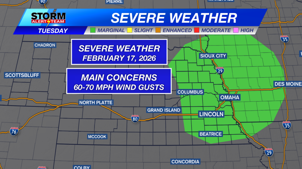
After a busy day of near-record high temperatures and heightened fire weather risk, we wrap it up with a chance for severe weather this evening. A Marginal Risk (level 1 out of 5) is in place for eastern Nebraska, with the main concern in stronger storms being damaging winds.
- For up-to-the-minute radar: CLICK HERE.
- For the latest warnings: CLICK HERE.
- For a live look at our Nebraska Weather Cams: CLICK HERE.
- And we would love to see video of any storm footage you may get (safely!). You can upload that using our Now Local News App: CLICK HERE.
Here is the latest timing on showers and thunderstorms across eastern Nebraska this evening.
Additionally, a Red Flag Warning is in place for much of the state until 10 p.m. CST.
Overnight temperatures look to be very mild for mid-February across southeast Nebraska.
After this evening’s chances for rain, we should clear through the overnight hours in Lincoln.
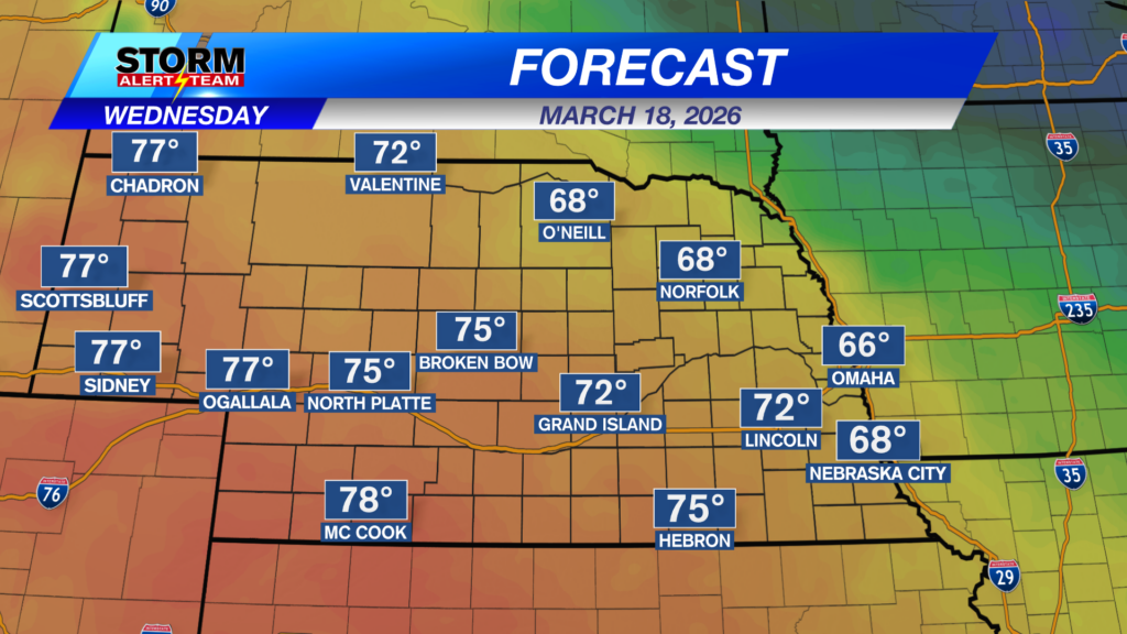
Wednesday will be “cooler” following Tuesday’s cold front, dropping temperatures to the lower and middle 60s.
Still a little breezy tomorrow in Lincoln, but afternoon conditions should be pleasant.
Wintry precipitation chances hit the forecast later this week, starting out west late Wednesday evening and moving east through Thursday morning. The latest run of StormCast keeps most of the precipitation at or to the north of Interstate 80.
Models continue to hash out how far south this system will spread, but for the moment the best chances of accumulating snowfall look to be north of Interstate 80.
Chances for flurries will be possible Friday and into Saturday as another system passes off to our south heading into the weekend. Temperatures look a little more like February through Monday, before making another jump into the 50s during the middle of next week.
Storm Alert Team Meteorologist
Dominic Ferraro
X: Dom_FerraroWX
Facebook: DomFerraroWX
YouTube: Dom_FerraroWX
Categories: Channel 8 Eyewitness News Weather, Forecast
Tags: Aurora, Beatrice, cooler on Wednesday, damaging winds, forecast, Grand Island, Hastings, Kearney, lincoln, McCook, red flag warning, severe weather, seward, weather