INDIANAPOLIS (WISH) — We are monitoring a strong to severe storm threat into our Thursday night and early Friday morning. This will be followed up with a big temperature drop into Friday, but it won’t take long for us to warm back up.
Tonight’s severe threat gives way to a Storm Track 8 Weather Alert.
Thursday night: Showers and storms will fire off near and behind a cold front, and there is potential for stuff to be just ahead of the front, but it is not guaranteed. Discrete cells look to first form to our north with activity congealing more into a cluster further down into central Indiana.
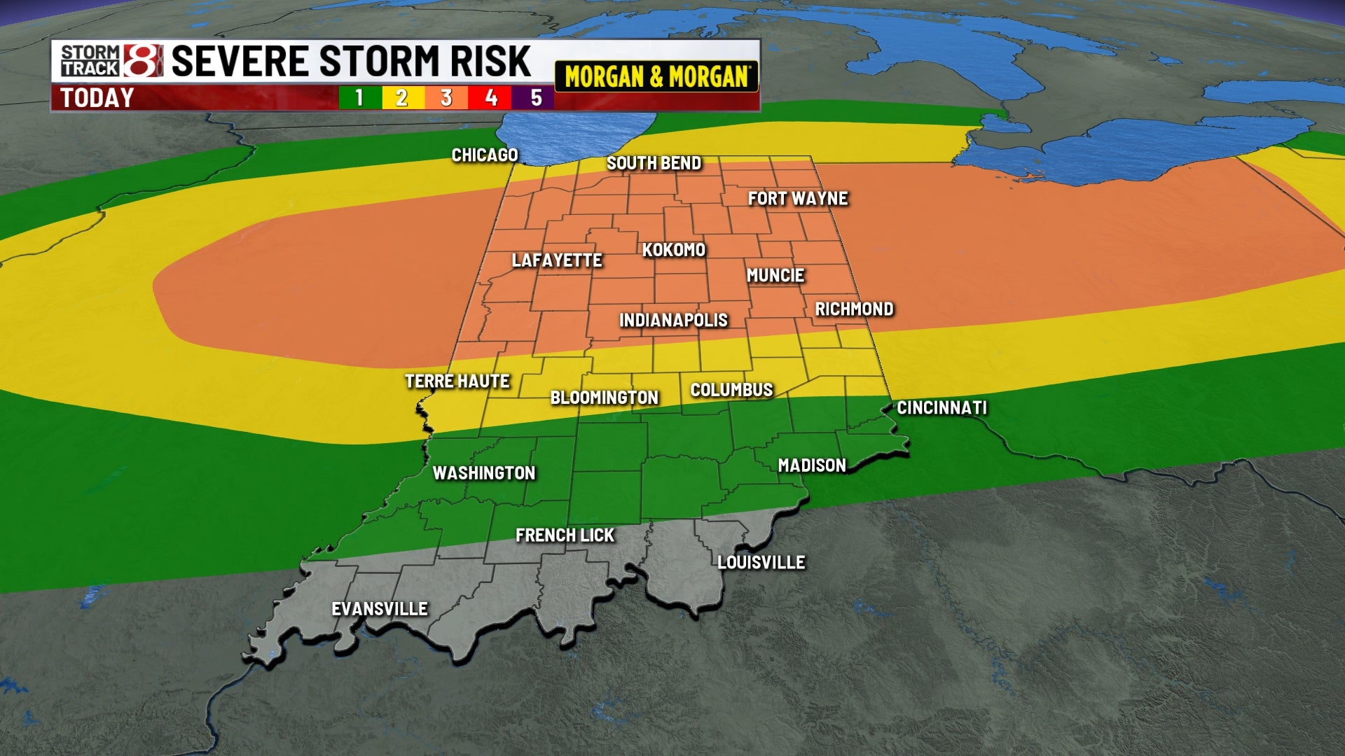
There remains a level 3/5 strong to severe storm risk along and north of interstate 70. Hail and wind are still the primary threats. Isolated tornadoes are also possible, but this threat is low.
Flooding concerns are also on the table for areas that get prolonged heavier rain. Those who do will see up to 1-2″+ of rain.
Lows in the low 40s with breezy winds continuing.
Friday: Showers will continue to move out of central Indiana through sunrise Friday. This leads way to a much cooler day overall with breezy winds. Highs will only get into the upper 40s. Clouds will also slowly decrease throughout the day as well.
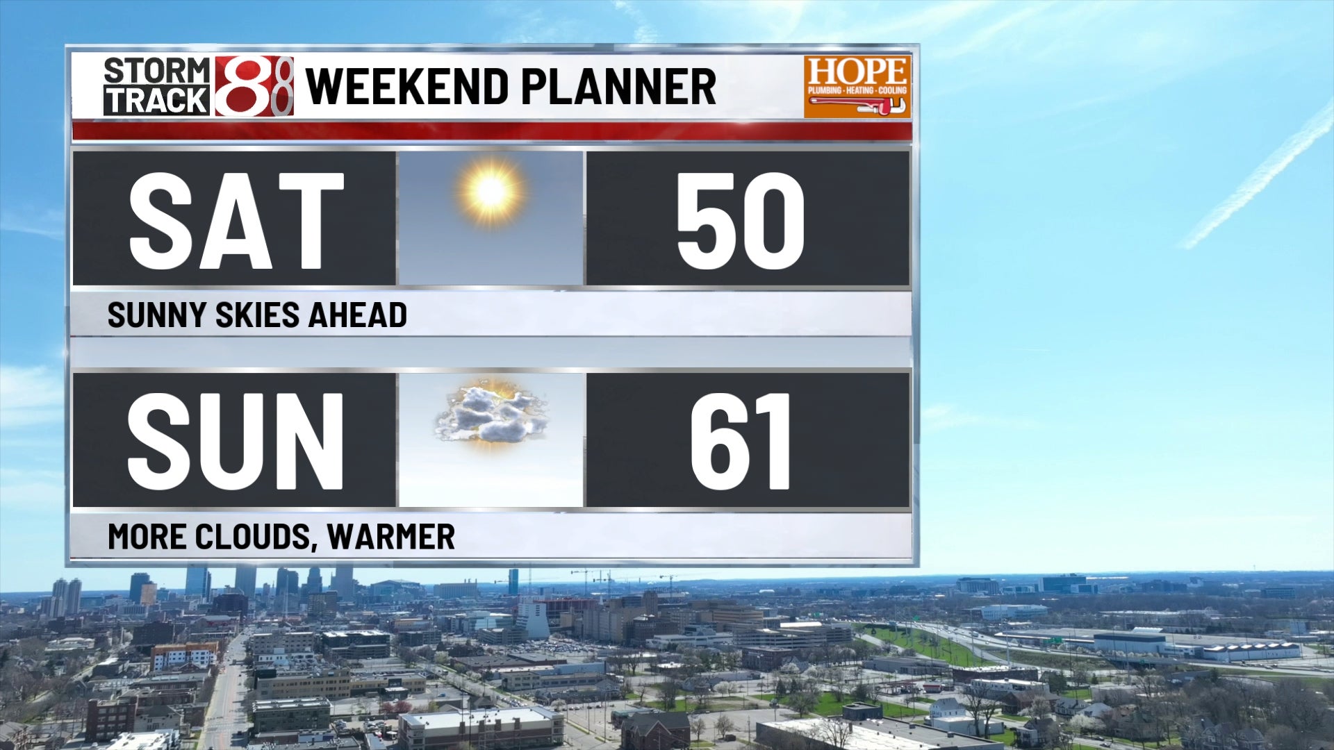
Saturday: Expect plenty of sunshine with temperatures staying below normal. Highs look to sneak into the low 50s.
7-Day Forecast: Prepare for another big warmup with highs back into the 60s Sunday, and then the 70s on Monday. Multiple chances for showers and storms are ahead next week through the end of March on Tuesday into the start of April on Wednesday.