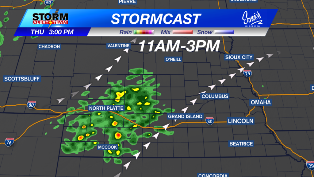
Another chilly & rainy day across parts of the state. Highs reaching the 50s, 60s & 70s under partly/cloudy skies. Rain showers will occur through the afternoon across SW->NE Nebraska. Rain accumulations up to 0.75″+ across NW Nebraska through Thursday.
By 10am-noon Thursday, scattered rain showers will occur across SW Nebraska.
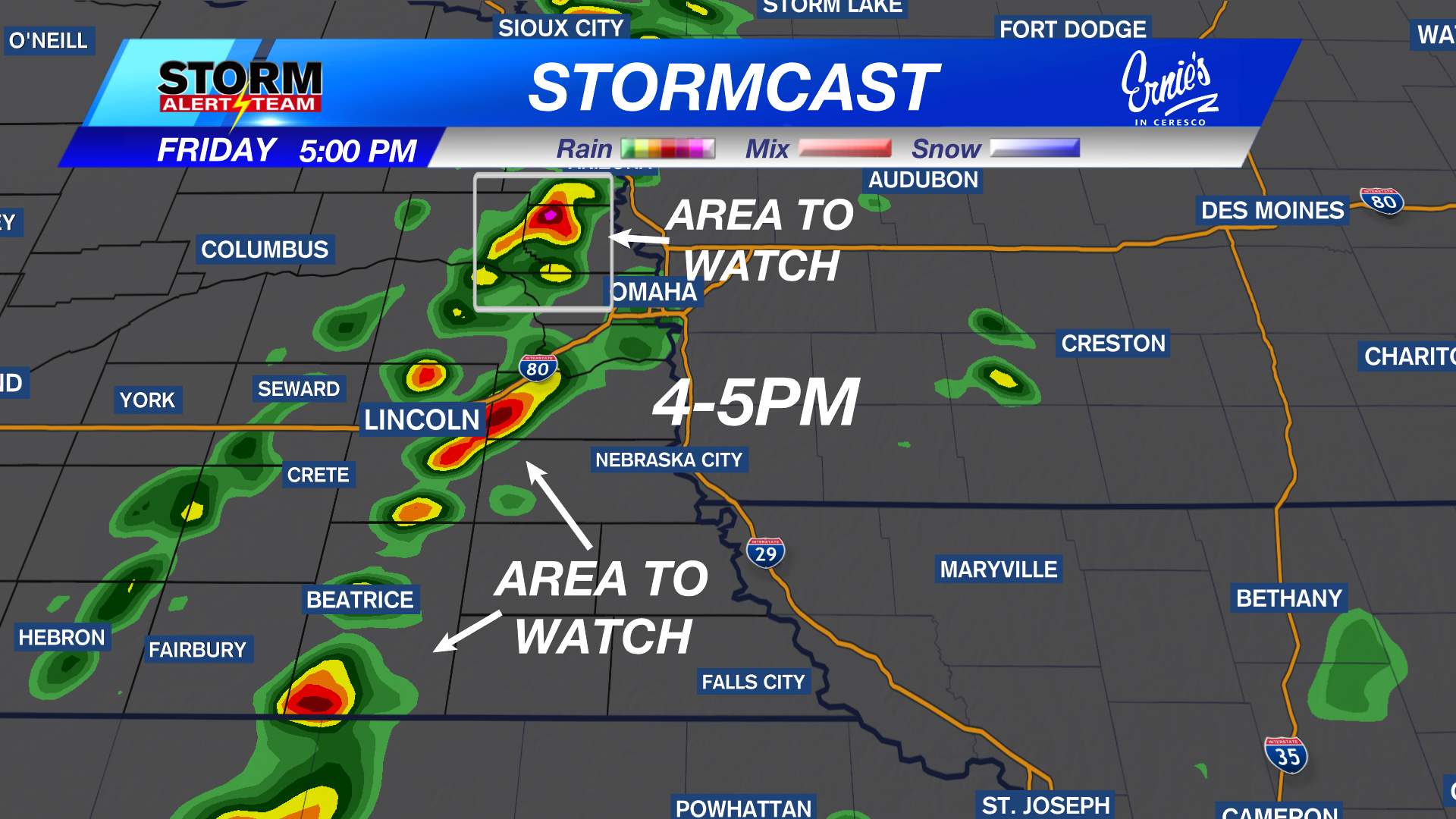
Thursday evening and night, widespread rain & T-storms will develop from W->E. Eastern Nebraska will see some rain and thunderstorms by the mid morning through the afternoon Friday!
High temperatures will vary Thursday afternoon. Sunshine will occur from Grand Island & north before cloudy skies and rain take over by noon. Much of the state reaching the 60s and 70s. AVERAGE: 77 degrees.
Thursday-Friday rain/storm Timeline:
1-3pm: Isolated storms will occur near Columbus-S->E. Pea to quarter hail could occur.
5-8pm:Isolated storms continue from Omaha->Beatrice. The strongest storms look to be near Beatrice & north of Omaha. A MARGINAL SEVERE threat could occur Friday due to quarter size hail & gusty winds. Rain moves out by Saturday & the warmth moves in!
Rain accumulations through Friday night look to range from 0.50″-1.25″+ across Nebraska. The better rain totals farther west!!
Rain/storm chances Thursday into Friday across SW & eastern Nebraska. A warm and pleasant Memorial Day weekend. We heat up Memorial Day with increasing moisture chances mid to late week!
Meteorologist Houston Hall
Facebook: HHallWX
YouTube: HHallWX
Tags: #klkntv, Beatrice, breezy, channel 8 weather, cool, forecast, Grand Island, hail, Hastings, hot, lincoln, McCook, Nebraska, North Platte, Omaha, rain, Spring, warm, weather, Wind