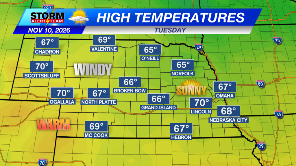
A PLEASANT day across Nebraska under mostly sunny skies! High temperatures statewide ranging from 67° – 74° with dew points in the 20s/30s!
NW->SW wind gusts up to 15-25+ mph farther west this afternoon! Winds RAMP UP Wednesday morning.
Wind gusts will be strongest Wednesday, Thursday & Saturday. Cold NW winds will stay through Friday before warmer SE winds return Saturday!
Friday morning will bring a hard freeze to parts of E Nebraska. Morning temperatures will range from 23° – 30° for several hours.
Sunday morning could bring a few rain showers across SE & E Nebraska. Light rainfall totals of 0.10″–0.25″ are most likely.
High temperatures look to stay near 55° – 62° through the next 10 days! *Morning temperatures look to cool near 25° – 45°! A clipper system brings COLD temperatures Thursday & Friday across eastern Nebraska! Expect a HARD FREEZE Friday & Saturday morning! Small rain chances in E Nebraska Sunday. The next system to watch comes NOV 20-22.
Meteorologist Houston Hall
Facebook: HHallWX
YouTube: HHallWX
Tags: #klkntv, Beatrice, blustery, channel 8 weather, cold, cool, Fall, forecast, freeze, frost, Grand Island, hard freeze, Hastings, lincoln, McCook, Nebraska, North Platte, Omaha, rain, warm, weather, Wind