INDIANAPOLIS (WISH) – Breezy conditions continue today and through the rest of the week. Temperatures will be close to normal today but they begin to dramatically drop for the end of the week. Some spots across parts of Indiana could see some frost and even freezing conditions as well.
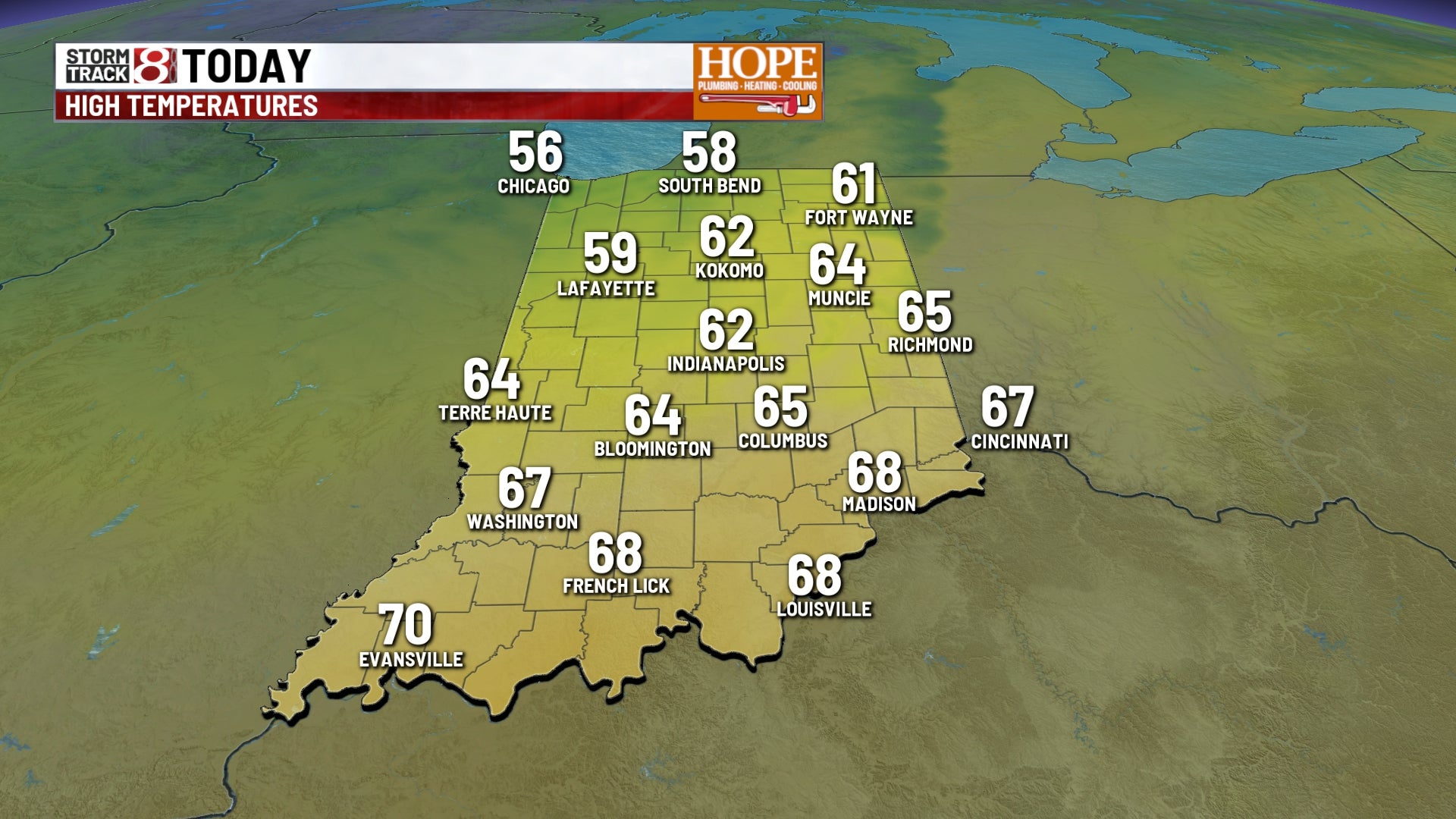
TODAY: Not a bad start to the morning with temperatures into the upper 40s and lower ’50s across parts of Central Indiana. We are clear now but skies become partly cloudy later this afternoon. Winds ramp up as well with gusts possibly near 20 and 30 mph. A few isolated showers could be possible after the evening rush hour. High temperatures today will be right around 62 which is one or two degrees below normal for this time of the year.
TONIGHT: Winds continue to stay a bit breezy tonight and we will clear out. Temperatures will fall into the lower 40s in Indianapolis.
TOMORROW: A much cooler day in store for your Wednesday. Look for mostly sunny skies. High temperatures will only be into the middle 50s which will be about 8 to 10 degrees below normal for this time of year. We will see the winds a bit gusty as well and could gust 20 to 25 miles per hour.
7 DAY EXTENDED FORECAST: Cooler conditions for the end of the week. Highs will be below normal into the upper ’50s on Thursday and near 60 on Friday. Lots of sunshine expected for your Thursday and Friday with rain chances moving in for the weekend. Spotty showers possible on Saturday with some showers late in the day into the evening on Sunday.
We could see some Frosty conditions early Thursday and Friday morning as temperatures fall into the ’30s. Some locations could drop into the lower 30s which means we could see a few areas seeing their first freeze of the season.