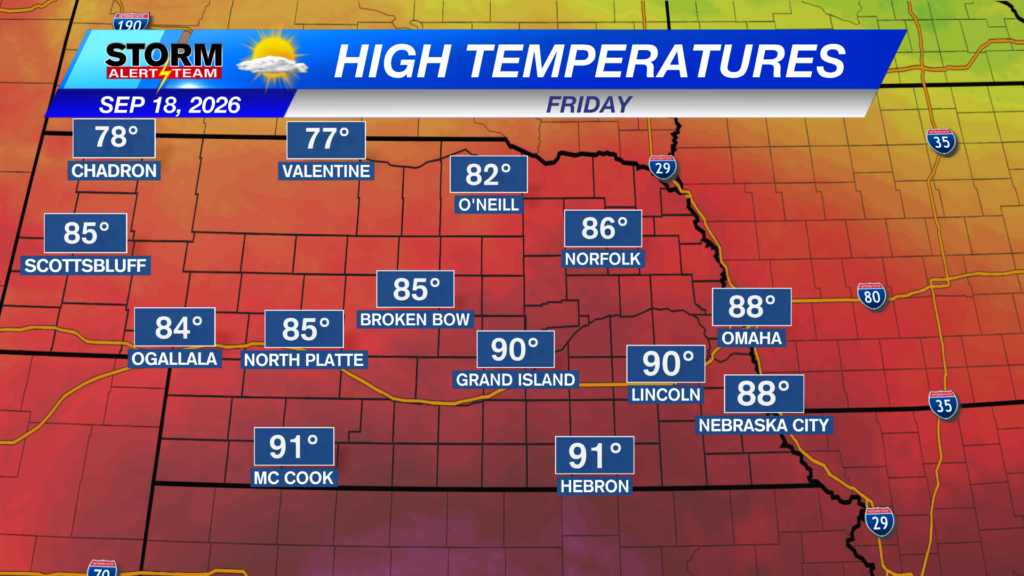
A HOT, windy & humid day across eastern Nebraska! High temperatures ranging from 78° – 94° with dew points in the 60s/70s! Sunny skies will also occur!
SW winds will be breezy across eastern Nebraska. Gusts up to 30+ mph ahead of the cold front.
Our GOTW & any high school football games look to be warm and breezy! Temperatures in the 70s with breezy SW winds up to 20 mph. Rain & storm chances will be possible starting near 8pm from Grand Island & eastward.
7-10pm:Isolated T-storms will develop from Red Cloud & areas east of the Tri-cities up to Columbus. Any SEVERE storm will likely have gusty winds up to 50-60 mph, lightning, small hail & heavy rain.
Rainfall through midnight shows a few areas of interest for rain and storm positioning.
Friday, some SUNSHINE pops out bringing warm & moist air before, another cold front moves through. A few storms Friday evening ahead of the front. This weekend & beyond looks cool with cloudy skies persisting.
Meteorologist Houston Hall
Facebook: HHallWX
YouTube: HHallWX
Tags: #klkntv, Beatrice, channel 8 weather, cool, damaging winds, dense fog, Fall, flooding, forecast, Grand Island, Hastings, High school football, lincoln, McCook, Nebraska, North Platte, Omaha, rain, severe weather, warm, weather, Wind