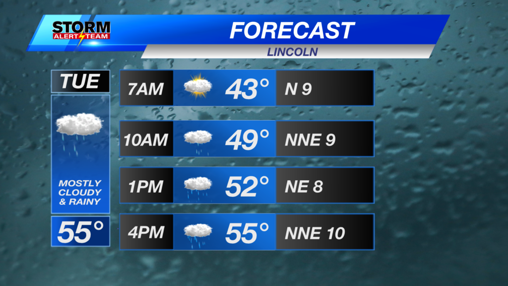
A Chilly & rainy Tuesday across Nebraska! Light rain/snow farther west through 1pm. Lincoln will likely see rain starting noon-4pm. More rain accumulation farther west!
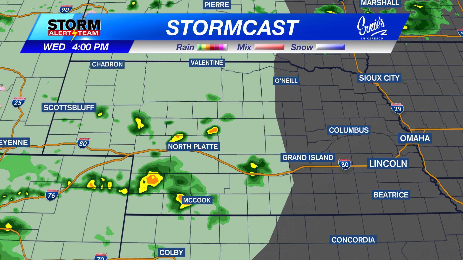
Light rain will be on/off through this morning across SE Nebraska. By 11am-1pm, the bulk of the precipitation will occur in Lincoln and along I-80. This continues through Tuesday evening. Wednesday afternoon and evening, a few isolated showers & T-storms will move down from the NW. A small severe threat with any isolated storm. Small hail & gusty winds would be the main concerns.
Picking up the kids from school this afternoon? There will likely be some light rain falling during this time across Lincoln & SE Nebraska.
State highs only reaching the 40s & 50s! The cooler spots farther west where snow has fallen. The warmer spots in SE Nebraska due to some morning sunshine.
Rainfall potential through Wednesday evening looks to stay near or below a quarter of an inch for most. Better accumulations farther west, where they need it most!
A few non severe showers & T-storms will develop out west Wednesday evening. A small severe threat could exist due to small hail & gusty winds. The circled area is where the best potential for a severe storm.
Light rain continues Tuesday afternoon & evening along and north of I-80. Wednesday starts our brief warm up due to sunshine coming out. The weekend is looking BEAUTIFUL. Temperatures look to stay in the 60s & 70s through the first week of May.
Meteorologist Houston Hall
Facebook: HHallWX
YouTube: HHallWX
Tags: #klkntv, Beatrice, breezy, channel 8 weather, cold, cool, forecast, freezing temps, Grand Island, Hastings, lincoln, McCook, Nebraska, North Platte, Omaha, rain, Spring, warm, weather, Wind