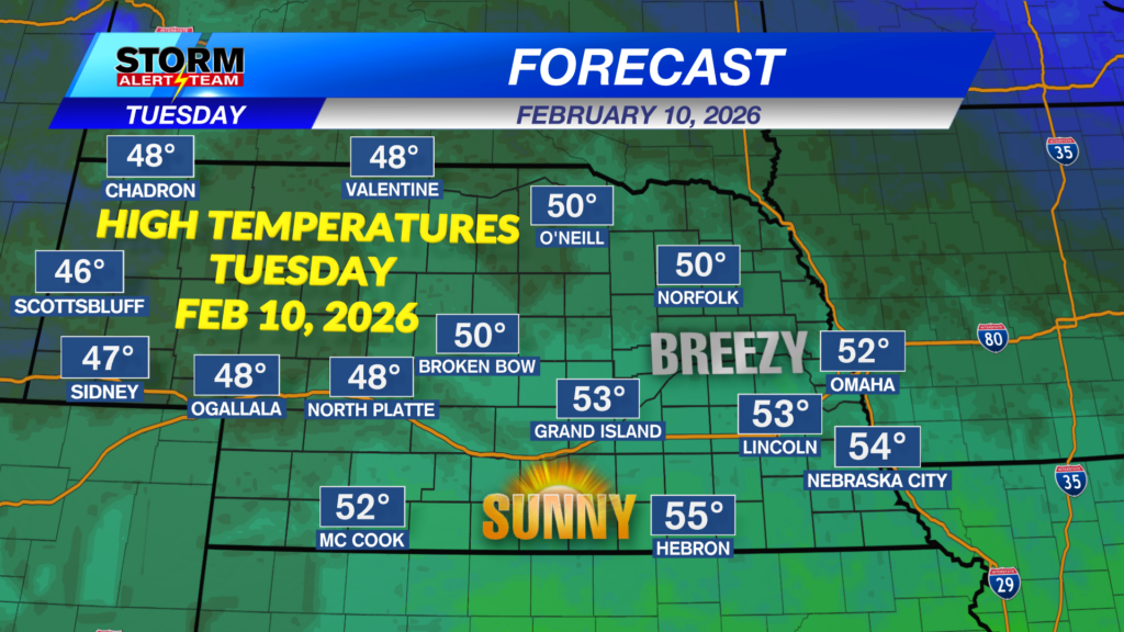
Today will be much cooler across the state! High temperatures only reaching the 40s & 50s under partly/mostly sunny skies. North winds will gradually relax by 3pm across eastern Nebraska, setting up a pleasant evening.
Breezy north winds will persist through the morning hours before relaxing this afternoon and evening. Temperatures will feel a few degrees cooler due to these winds.
Very light rain is possible Wednesday evening across northeast Nebraska associated with a weak disturbance. Rain that does fall will only amount to a few hundredths.
Next week could bring better chances for much needed moisture across the Midwest! The best days for precipitation look to be February 18-21. Warmer air = more moisture, making for better precipitation chances.
Days to watch: Models hint at our next weather system developing near Feb 19–21, bringing rain, snow and colder air to the Midwest and Central Plains. A few additional systems may follow into late-February, opening the door for more colder air, rain & snow potential. Stay tuned for the latest heading into next week.
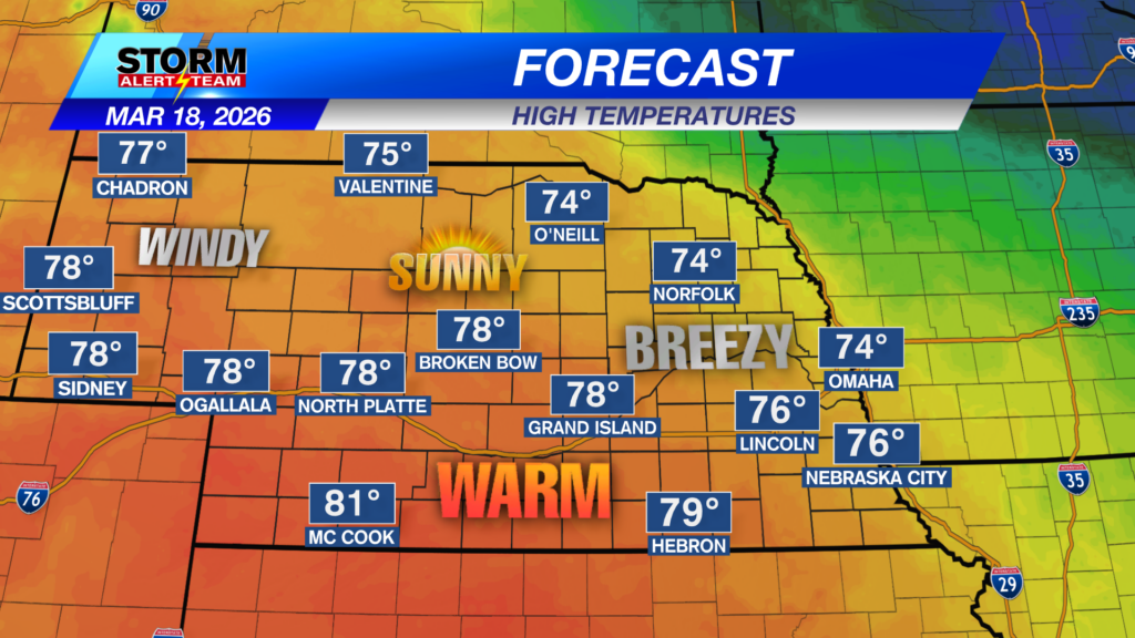
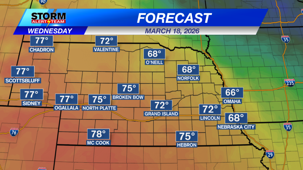
Today will be much cooler across the state! This week will stay well above average with a few light RAIN chances starting Thursday. Saturday looks like the best chance for light measurable rain south of I-80. Next week brings warmer air, moisture and better rain chances by Thursday.
Meteorologist Houston Hall
Facebook: HHallWX
YouTube: HHallWX
Tags: #klkntv, above average, Beatrice, breezy, channel 8 weather, clouds, cool, forecast, Grand Island, Hastings, lincoln, McCook, Nebraska, North Platte, Omaha, rain, Spring, warm, weather