A chilly & rainy day across parts of the state. Highs only reaching the 50s & 60s under partly sunny skies. Rain showers will occur through the afternoon mainly west & north of Grand Island. Rain accumulations up to 0.25″ through tonight. More rain is on the way Thursday & Friday!!
The peak window for rain will be from 2pm-6pm across western Nebraska. Eastern Nebraska will stay dry through Wednesday!
Rainfall accumulations ranging from a few tenths to over 0.25″ through Wednesday night! Much needed rainfall for areas west.
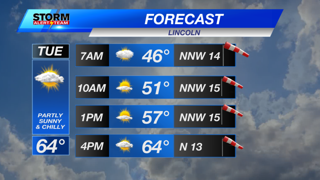
Another well below average day for high temperatures. Much COOLER where rain will occur this afternoon. The warmest spots will occur in SE Nebraska. Highs ranging from the 50s to upper 60s.
Here’s a look at when and where to expect rain starting Thursday through Friday:
Rain accumulations through Friday look to range from 0.25″-0.75″+ across Nebraska. The better rain totals farther west!!
A much cooler rest of the week with rain/storm chances Thursday morning into Friday across eastern Nebraska. A warm and pleasant Memorial Day weekend. We heat up Memorial Day with increasing moisture chances mid week!
Meteorologist Houston Hall
Facebook: HHallWX
YouTube: HHallWX
Tags: #klkntv, Beatrice, breezy, channel 8 weather, cool, forecast, Grand Island, hail, Hastings, hot, lincoln, McCook, Nebraska, North Platte, Omaha, rain, Spring, warm, weather, Wind