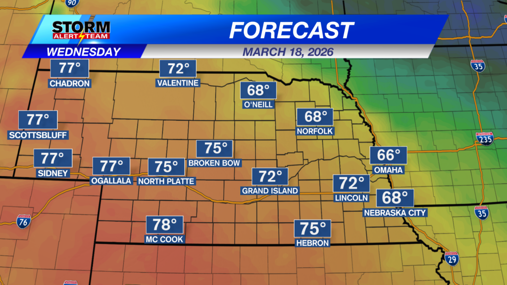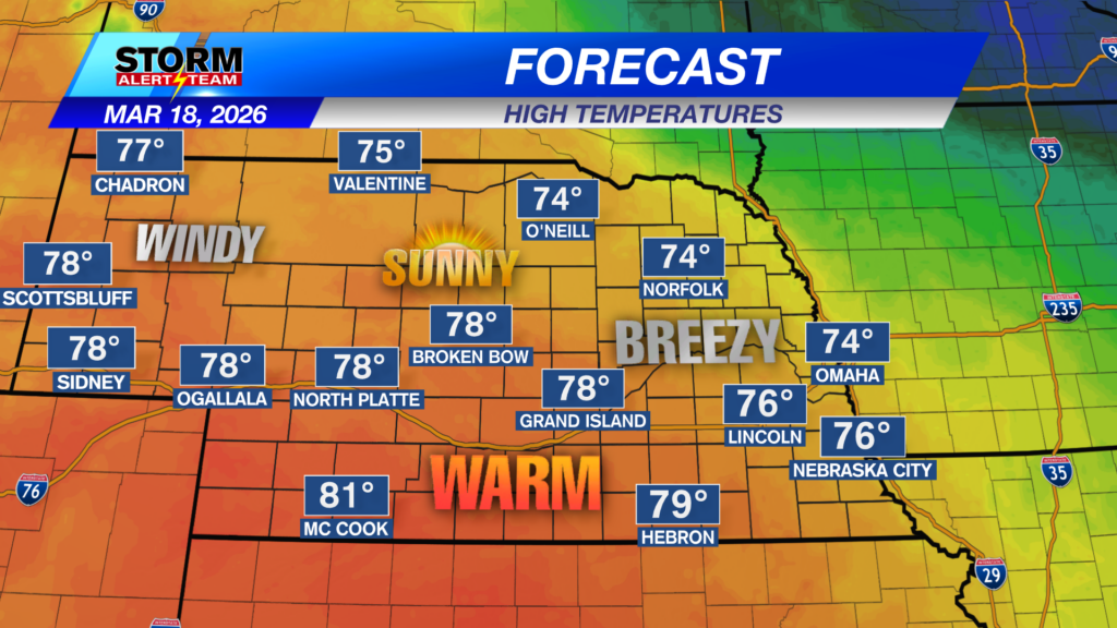
The warmth & sunshine has arrived for everyone! Temperatures will be much warmer in the 70s with gusty winds fueling FIRE weather by 2pm out west. Farther east, winds will stay light with a breeze at times!
NW winds will continue to gust near 30-35 mph across western Nebraska by 2pm. This will add to the critical fire weather currently ongoing. Substained winds between 5-10 mph with gusts up to 20+ mph farther east.
Record breaking warmth arrives Friday!
- Friday’s record:80° (2022). Forecasted highs: 83°-90°.
- Saturday’s record:88° (1907). Forecasted highs: 85°-94°. This record will be a close one!
Friday, temperatures in the low to upper 80s under sunny skies. NW winds 5-15 mph.
Saturday, temperatures in the 80s and several low 90s farther south. SW winds 15-20 mph.
A warm & breezy Wednesday. Thursday looks even better, temperatures in the 70s and 80s with winds a bit lighter across the state. Friday & Saturday brings record warmth! Some spots could see the lower 90s on Friday and Saturday. A cold front moves through Sunday with our next spotty precipitation chance coming near March 24-26. Through the end of March, precipitation totals look to remain below 0.10″ for most.
Meteorologist Houston Hall
Facebook: HHallWX
YouTube: HHallWX
Tags: #klkntv, Beatrice, breezy, channel 8 weather, fire danger, forecast, Grand Island, Hastings, lincoln, McCook, Nebraska, North Platte, Omaha, rain, red flag warning, snow, Spring, warm, weather, Wind