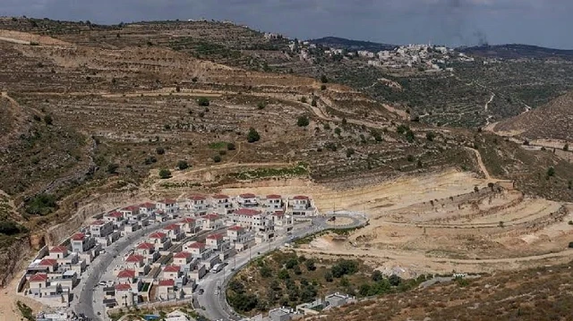
Israeli authorities have redrawn the boundaries of a 42-year-old “state land” declaration in the occupied West Bank, adding nearly 194 dunams (48 acres) of Palestinian land near the villages of Jalud and Al-Mughayyir while removing a smaller parcel elsewhere, according to the Colonization and Wall Resistance Commission. The Palestinian government agency said Tuesday that the “Blue Line Team” approved the inclusion of 193.93 dunams in the 1984 declaration, removed 15.07 dunams from previous boundaries, and left 1,433.85 dunams unchanged — resulting in a net increase of approximately 179 dunams.
The measure does not automatically expand the settlement’s area of influence, but it makes the added land available for possible planning or allocation procedures at later stages.
Geographic context
Jalud lies southeast of Nablus, while Al-Mughayyir sits northeast of Ramallah in an area witnessing continuous expansion of illegal settlements and outposts, the commission noted. The region has faced increasing restrictions on agricultural land use and grazing areas as Israeli authorities employ various tools to control Palestinian territory.
Broader land strategy
This move represents part of a broader strategy in which Israeli authorities use boundary modifications to strengthen settlement expansion, the commission said. In August, the agency reported that Israeli authorities declared approximately 1,152 dunams of land belonging to Sinjil, Al-Lubban ash-Sharqiya and Qaryut as “government property,” aiming to expand the Karmei Oz settlement and strengthen geographical contiguity between settlements and outposts in the area between northern Ramallah and southern Nablus. Israeli settlements established in the occupied West Bank are considered illegal under international law.