
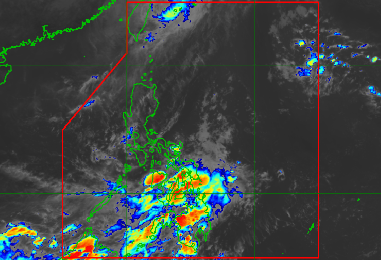
As of Saturday afternoon, October 24, no new low pressure areas or potential tropical cyclones are being monitored inside or outside the Philippine Area of Responsibility
MANILA, Philippines – Typhoon Rosal (Champi) exited the Philippine Area of Responsibility (PAR) on Saturday morning, October 24, then left the weather bureau’s monitoring domain in the afternoon.
At the time of its exit from PAR, Rosal’s maximum sustained winds were already down to 120 kilometers per hour. During its peak, it was a super typhoon with maximum sustained winds of 215 km/h.
Rosal did not make landfall in the Philippines, but it affected parts of Northern Luzon, especially the northernmost province of Batanes. It brought moderate to intense rain, as well as winds up to Signal No. 2.
The trough or extension of the tropical cyclone has also affected various areas in Luzon, the Visayas, and even Mindanao in the past days.
On Saturday afternoon, the Philippine Atmospheric, Geophysical, and Astronomical Services Administration (PAGASA) said scattered rain and thunderstorms due to Rosal’s trough will only be confined to Batanes, Ilocos Norte, Apayao, and Babuyan Islands in the coming hours.
Rosal entered PAR last Tuesday, October 20, becoming the Philippines’ 18th tropical cyclone for 2026, and the first for October. PAGASA earlier estimated the country may have one or two tropical cyclones during the month.
So far, no new low pressure areas or potential tropical cyclones are being monitored inside or outside PAR.
Meanwhile, the intertropical convergence zone (ITCZ) is bringing scattered rain and thunderstorms to the Visayas, Mindanao, Sorsogon, Masbate, and Palawan on Saturday evening. Flash floods and landslides are possible.
The ITCZ is a belt near the equator where the trade winds of the Northern Hemisphere and the Southern Hemisphere meet.
The Philippines is currently in a transition period to the northeast monsoon or amihan, following the end of the southwest monsoon or habagat, which was announced last October 5.
The northeast monsoon typically brings surges of cold temperatures, but the upcoming amihan period could be warmer as the existing strong El Niño in the tropical Pacific Ocean is predicted to become very strong in the fourth quarter of 2026. – Rappler.com