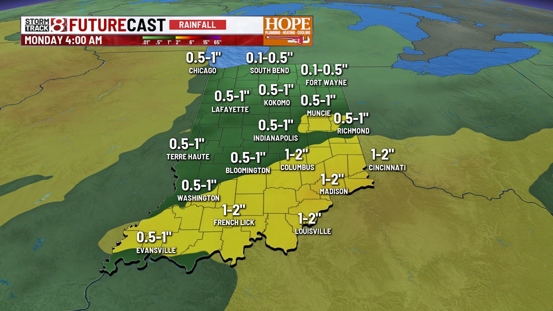
INDIANAPOLIS (WISH) — Central Indiana is in for one more pleasant Thursday before a slow-moving storm system arrives and brings the threat of heavy rain and localized flooding for the start of the weekend.
Thursday’s Pleasant Weather
High pressure remains parked overhead today, keeping our weather stable, dry, and pleasant.
Heavy Rain and Flooding Threat: Friday Night Through Saturday
The quiet, pleasant weather pattern we’ve enjoyed this week is about to come to an abrupt end as a storm system moves in from the Missouri Valley late Friday.
Timeline of Events:
Friday:
- Morning: Increasing clouds, still dry
- Afternoon: First showers and storms arrive from the west (2-6 p.m.)
- Evening: Rain becomes more widespread and heavier (6 p.m.-midnight)
- Overnight: Heavy rain and thunderstorms likely, flooding concerns increase
Saturday:
- Early morning: Continued heavy rain and embedded thunderstorms (midnight-8 a.m.)
- Late morning: Rain may briefly lighten up, but more storms develop
- Afternoon: Scattered storms continue, gradually diminishing (1-6 p.m.)
- Evening: Rain finally tapering off, clouds breaking up
This storm system is moving very slowly and has very little “steering” from the winds high up in the atmosphere. When weather systems move slowly, they drop their rain over the same general area for an extended period of time, and rainfall totals can add up quickly.
Much of central Indiana could see between 1-2″ of rainfall, but some locally higher amounts could be possible for those that see several downpours, or “training” of storms.
Storm Severity Concerns: Not Just About Rain
While flooding is the primary concern with this system, we also need to watch for the potential for severe weather, particularly in southeastern Indiana where atmospheric conditions will be more unstable. Damaging wind gusts, and even a quick spin up of a tornado is possible.
Sunday Improvement, Then Heat Builds for August
Once this weekend’s storm system finally moves out Saturday evening, the weather pattern is going to shift dramatically as we head into the first week of August.
Sunday’s Forecast:
Sunday afternoon and evening should offer a decent opportunity to salvage the weekend. Just be aware that the morning might still feature some lingering clouds and perhaps a stray shower as the storm system finally exits.
Next Week: August Heat Arrives
As we flip the calendar to August this weekend, the weather pattern is going to make a significant change. The main jet stream—the fast-moving river of air high in the atmosphere that separates hot and cold air masses—is going to retreat well to our north.
When the jet stream moves north, it opens the door for hot, humid air to surge northward from the Gulf of Mexico and the southern Plains. And that’s exactly what’s going to happen.
Early Look at Next Week: