ANOTHER round of Status Yellow warnings have been issued for nine counties after Storm Ingrid chaos.
The UK Met Office and Met Eireann issued the alerts ahead issued the alerts for Tuesday, which is expected to see “outbreaks of rain” across the affected counties.
Sign up for The Irish Sun newsletter
Thank you!
Ireland is set for more weather chaos on TuesdayCredit: Reuters
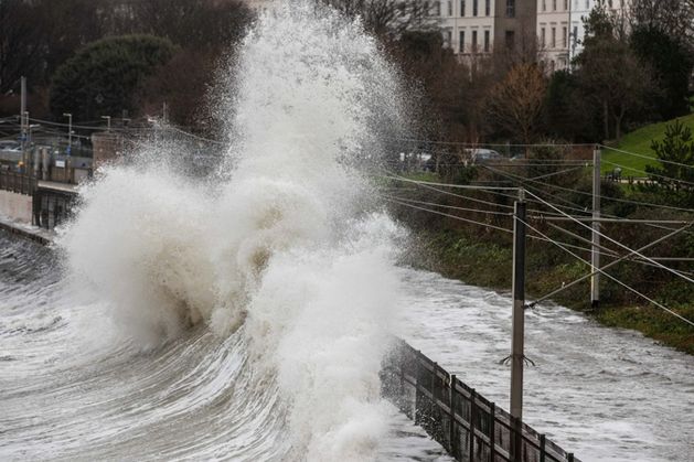
Heavy rain and gale force winds are to be expectedCredit: Meteologix.com
Temperatures will be a lot colderCredit: Meteologix.com
Met Eireann has Wicklow, Waterford and Wexford under a Status Yellow warning for rain, which comes into effect on Monday at midnight to 8pm on Tuesday.
The 20-hour alert warns of possible impacts, which include localised flooding and difficult travel conditions due to outbreaks of rain, which can be heavy at times.
Cathal Nolan from Ireland’s Weather Channel reports that the “low pressure will deepen rapidly on approach, resulting in a multi-hazard weather event with flooding, gales and hill snow all likely in parts of the country.”
The total of rainfall is estimated to be between 23-30mm but some parts of the east and northeast could see 30-50mm.
X FURY
Dublin City Council 1st local authority to ditch X amid Grok AI tool controversy
NEW UPDATE
Dublin Airport rolls out new pop-up exhibition in major boost for passengers
He warns that the Mourne and Wicklow Mountains could see up to 80-90mm of rainfall, with flooding highly likely to occur.
Not included in Met Eireann’s warning yet but Cathal reveals that gale-force easterly winds and hill snow are expected on Tuesday.
He added: “Other hazards include gale force easterly winds, later back southwesterly as the low pressure clears through, with gusts of up to 100km/h possible in coastal parts.
“Hill snow is also a risk, with accumulations possible above 200 metres, though at the time of writing temporary falls of snow are possible lower down too.”
The UK Met Office have placed the Northern Ireland counties under two status yellow alerts for Monday and Tuesday due to disruptive weather conditions.
A status yellow warning for rain has been issued for Armagh, Down, Fermanagh, Tyrone and Derry, kicking into effect at 12pm until 6pm on Monday.
They warn that “heavy rain likely to bring some transport disruption and flooding in places.”
And another status yellow alert has been issued for all Northern Ireland counties over rain and wind, which comes into effect at 2am and remains in place until 6pm on Tuesday.
The UK Met Office states that the disruptive weather event will bring heavy rain and strong winds, potentially causing flooding and disruption in Northern Ireland.
Alan O’Reilly from Carlow Weather on social media today said: “River Slaney high and still rising here in Tullow while the River Derneen that feeds into Slaney also very high near Tullow.
“A break in the heavy rain today but plenty more to come on the Wicklow Mountains Monday and Tuesday with risk of flooding increasing.
“Slaney still rising after 129mm so far this month and over 90mm of that in last week. Forecast shows another 40mm possiblye by Thursday.”
WEATHER FORECAST
In a full forecast for today and tomorrow, Met Eireann’s Holly O’Neill said: “A rather dull start out there this morning with mist and fog patches slow to clear.
“Outbreaks of rain and drizzle will mostly affect the northern half of the country this morning, and through the day conditions will generally remain cloudy and dry, with just a few scattered outbreaks of rain and drizzle around.”
Temperatures are expected to see highs of 5 to 9 degrees with light or variable winds before dropping down to temps of 0 to 5 degrees.
Rain and drizzle will continue overnight with dry and clear conditions over parts of the southwest, with possibilities of frost and icy patches forming.
She added: “Frost and ice patches may form early on in the night, under any clear skies, with lowest temperatures of 0 to 5 degrees, feeling coldest in the southwest.
“Cloud will thicken towards morning, with heavy rain feeding in from the southwest. We’ll have light to moderate east to southeast or variable winds, stronger along west and north coasts.
“Another dull and wet day in store for Monday, with widespread rain persisting through the afternoon with heavy falls at times.”
IRISH WEATHER WARNINGS EXPLAINED
MET Eireann issues three categories of weather warnings, yellow, orange and red.
Each warning signifies a different danger level and different actions may need to be taken depending on what the weather event is and how bad it is expected to be.
Yellow weather warnings, which are usually used for localised danger, urges people who may be affected to “be aware”.
Met Eireann meteorologist Siobhan Ryan explained: “A Status Yellow weather alert is given to warn those at risk from certain weather because of their location and/or their activity.
“It advises these people to take preventative action. Expected weather conditions in a status yellow alert do not pose an immediate risk to the general population.”
A Status Orange alert sends the message that people should “be prepared”.
Ryan said: “A Status Orange weather warning is given before expected weather conditions that could significantly impact people, property and activity in an area.
“People in the affected areas should prepare appropriately now for the anticipated conditions.”
Status Red weather warnings are the most significant of the three and therefore carry the most cause for concern, with people under the alert urged to “take action”.
Ryan said: “A Status Red severe weather warning is rarely issued but when it is, people in the areas expected to be affected should take action to protect themselves and/or their properties.”
These three warning categories are issued whenever certain weather conditions are expected within a 48 hour window.
Monday will see highs of 4 to 10 degrees, with the coldest in the north, then dropping to the lowest temps of -2 to +1 degrees during the night.
Looking ahead of the week, Holly said: “Now, looking out to the rest of the week, it’s going to remain unsettled as low pressure continues to dominate our weather pattern, bringing further spells of rain across the country.
“It will be cold and breezy at times, too, with a chance of a few wintery showers later on in the week.”
The yellow warnings are set to come into effect for 9 countiesCredit: Reuters