Heavy rain will continue to drench parts of eastern Australia this weekend, with a risk of flooding around a number of rivers.
The weather system responsible has arrived from the outback where this month has already brought the highest rain totals in up to 15 years.
This rare desert drenching is the result of an intrusion of very humid tropical air — an airmass which is now over Queensland where it will stall for several days.
Loading…
Dry outback rivers in full flow
It has been an incredible week of rain and storms across central Australia.
Up to 200 millimetres fell in some pockets of the NT and SA, which for Kati Thanda-Lake Eyre, the driest part of Australia, is around a year’s worth of rain.
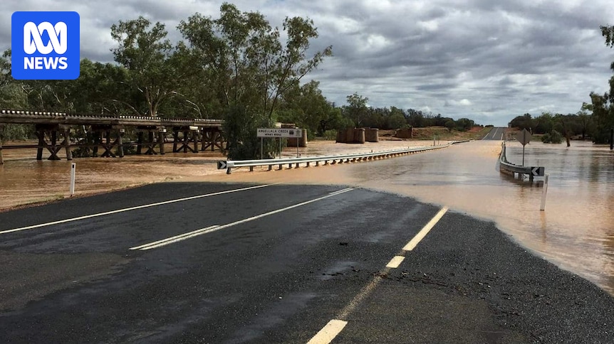
The rare desert drenching has brought the region to life, with normally dry creeks and rivers rising up to 5 metres in a matter of hours.
Satellite images shows creeks, rivers and lakes in north-east SA are damp or flowing after heavy rain this month. (Supplied: NASA)
In Alice Springs, the Todd River has been flowing since Saturday, after up to 191mm was recorded upstream, while the town’s airport collected 125mm in a week, triple the February average.
The moist air responsible is now contracting back to tropical and eastern Australia.
However, modelling is hinting another swathe of humid air from the north could return to central Australia towards the end of next week — meaning further heavy is possible before the end of the month.
Queensland faces a weekend of rain and storms
While skies are clearing over central Australia, the band of rain and storms has now shifted to the eastern seaboard.
The heaviest falls overnight swamped the far north coast of NSW, including 241mm at Doon Doon, just inland from Byron Bay.
Totals in excess of 100mm were also recorded around the Gold Coast, the heaviest rain since Cyclone Alfred.
Heading into Friday afternoon, the heaviest rain persisted around the Gold Coast and the adjacent inland where up to 30mm was falling per hour, and the Bureau of Meteorology’s (BOM) Severe Weather Warning indicated this pocket of heavy rain could shift north to Brisbane and the Sunshine Coast throughout the day.
On Saturday, the greatest risk of flash flooding will shift to a broad region of inland Queensland where thunderstorms remain a risk.
Severe thunderstorms with flash flooding are possible on Saturday from the Northern Goldfields to the Maranoa and Warrego. (Supplied)
However, heavy rain not associated with lightning and thunder could also impact south-east Queensland and northern NSW this weekend — especially if a region of moist converging winds develops near the coastline.
All up, modelling shows between now and Monday another 50 to 100mm is likely in a broad band from inland tropical Queensland to the far north coast of NSW, prompting a flood watch for more than 20 rivers from the Central Highlands to the Northern Rivers.
However, as we saw last night, isolated totals well above 100mm are possible in this humid environment, sometimes in a matter of hours.