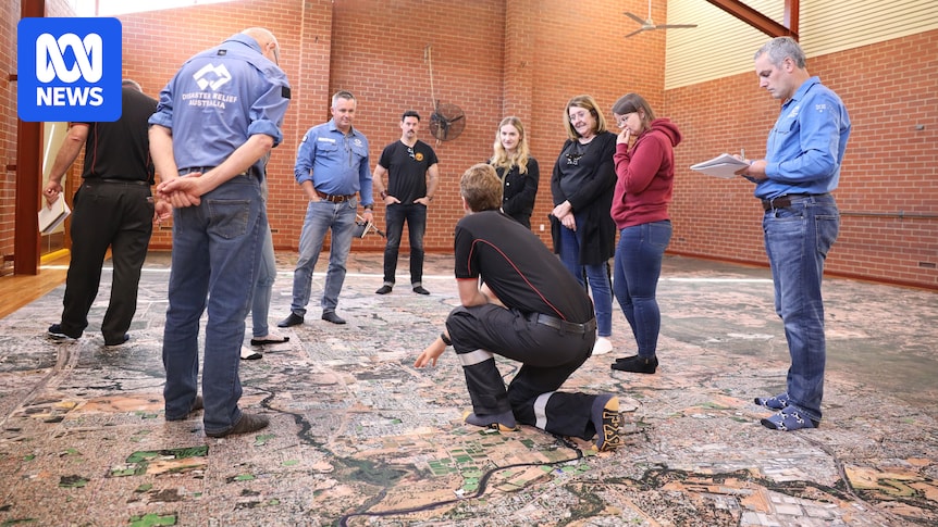
When Disaster Relief Australia (DRA) comes into a community to run a big map exercise, it is literally that.
They print a large, full-colour satellite map of the town or local government area they are working with and invite community members in to walk on it.
“The first thing they say is, ‘Oh, that’s a big map,'” said Shari Bent, DRA’s associate director.
“But automatically, people are drawn in and they find their house.
“Once they find their house, they take a step back and they start identifying friends and family’s houses, and then they start identifying places that they know.”
‘War gaming’ disaster readiness
DRA is a veteran-led volunteer organisation that works with communities to prepare for and recover from disasters.
‘What was going to burn?’
The threat of bushfire never occurred to Natasha Turfrey and Denis Grzetic. After all, they lived in a more or less treeless Perth estate — and still do, thanks to sheer chance.
Once people have had a good look around their neighbourhood, the serious work starts, using the maps to help people identify risks of flood, fire and storms.
“We find across the country that people really don’t understand the risks and hazards that they face,” Ms Bent said.
“People walk on the map and go, ‘Oh, I didn’t realise I had so much bush behind me’, or ‘I didn’t realise there was a river there’.
“It’s just a unique, different perspective to understand where they live.”
Once they have identified the hazards, DRA teaches people how to access the other information they need to survive and takes a “military war gaming approach”.
“[In war], they draw maps in the sand and then work through exercises and what might happen and probabilities and that kind of thing,” Ms Bent said.
“We’ve taken that theory and applied it to communities.”
Powerful communication tool
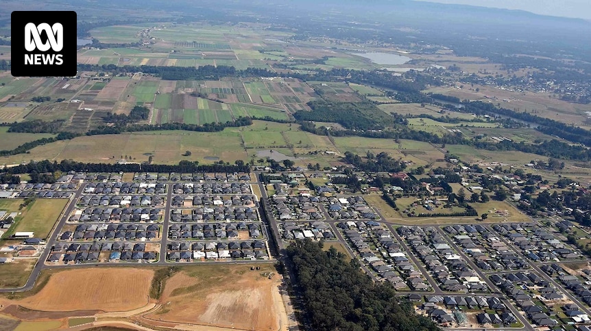
The City of Swan, in Perth’s eastern fringe, did a big map exercise in late 2024 with a 10 by 12-metre map in a community hall.
Mayor Tanya Richardson said the map was an amazing visual representation which helped her and the others who used it better understand the topography.
“Swan is topographically so big for a metropolitan council — we have an urban area, but then we also have Gidgegannup and Bullsbrook and bushland areas.
“It really gives you a great bird’s-eye view of that map and where the potential risks are, and you’re also able to see the navigational lines.”
A huge plume of smoke from a bushfire burning in the City of Swan in Perth’s hills in March 2024. (Supplied: Jazzi Sandilands)
Primary school children came into the hall as well and “had a ball” finding their homes and the local waterways and landmarks.
“The kids thoroughly enjoyed being able to pinpoint where their home was and to understand where the hills are and where fire sometimes comes from,” Cr Richardson said.
The map, which the city was given to keep, will become a “fantastic asset” not just for preparedness, but in helping the community understand what is going on during a bushfire.
Cr Richardson anticipates being able to roll out the map at public meetings when a fire hits, showing people where the fire is, where the safe and unsafe roads are and potentially, why they cannot return to their homes yet.
“It’s such a visually powerful tool to be able to have for the community,” she said.
“It can be folded up. It can be taken to be put on the ground. It could be put on an oval, just on a dirt patch — it’s portable.”
Lessening the impact
Ms Bent has seen firsthand the difference the big maps can make to disaster readiness.
“There is a little town in New South Wales called Willawarrin that was heavily impacted by the Black Summer fires,” she said.
“We did a big map [exercise] there and the RFS there took carriage of it, and they run it out every day at their Get Ready weekend. People can come in and walk on the map.
“I was fortunate enough to be present at one of their Get Ready days where we were talking through it.
“And about three weeks after that, they had another large fire and people actually came and said, ‘You know, I stood on that map, I saw what was around me and I went and made some changes and did some mitigation and got prepared and that actually saved my house.'”
Shari Bent says has has seen the big map exercise prepare communities for disaster. (ABC News: Emma Siossian)
For Ms Bent, preparation that mitigates the impacts of disasters on people is everything.
She has seen up close the stress and trauma on communities that suffered severe floods and fires.
“I was heavily impacted by Black Summer bushfires and my community was as well,” she said.
“We can’t stop these events happening. They are just getting larger in scale and happening more frequently, and we can’t stop them, but we can prepare for them.
“For me, that’s what it’s about — ensuring that when these things happen, communities are aware, and we lessen the impact.”