A lot is going to be changing over the next several days. We go from warm and windy, to mild and rainy, to below average temps, to a chance for rain/snow mix. All within a few days!
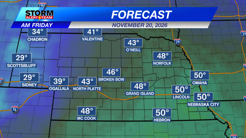
Friday will start off VERY mild. 50 degrees for a low? That’s our average high for the day.
We’ll be very near record highs Friday afternoon. The record high for Lincoln is 75 degrees. We’ll be close!
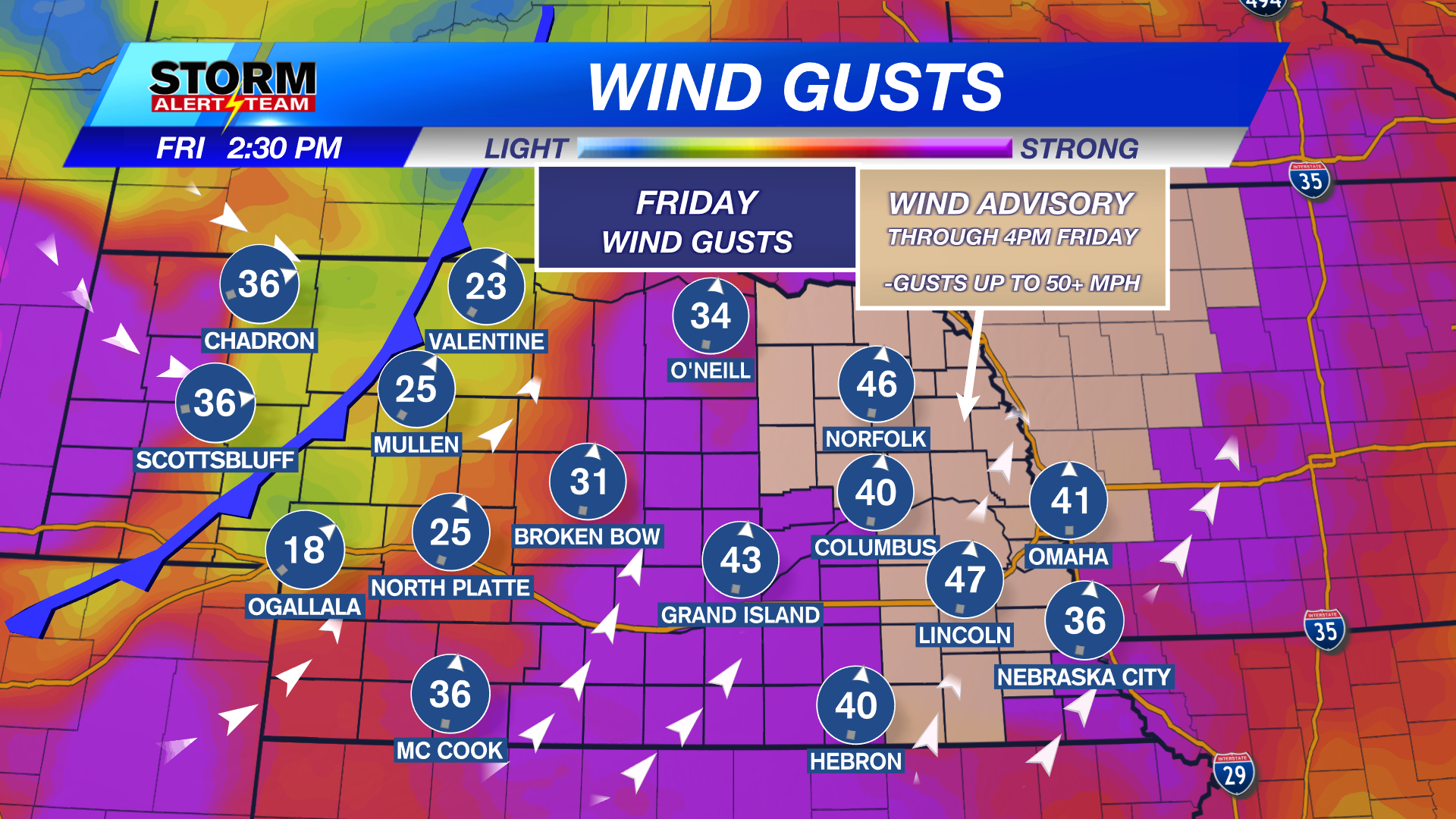
Part of the reason we’ll be so warm is a very gusty south wind. It will be gusting into the 40 mph range much of the day.
On Saturday, some light rain is possible through the afternoon into the evening hours.
Temperatures for the Huskers game will likely be warmer at kickoff vs the 4th quarter. The wind will be out of the northwest and rain is possible on and off.
As we look ahead to next week (above), light snow is possible in the western half of the state. This moisture will try to make it into eastern Nebraska by Tuesday evening as a rain/snow mix. It would be very light if it can make it this far east.
Chief Meteorologist Rusty Dawkins
Facebook: RustyWx
YouTube: RustyWx
TikTok: RustyWx
BlueSky: RustyWx
Instagram: RustyWx
Threads: RustyWx
Twitter: RustyWx
Categories: Channel 8 Eyewitness News Weather, Forecast
Tags: Beatrice, Broken Bow, channel-8-eyewitness-news-weather, Columbus, Crete, Fairbury, forecast, Grand Island, Hastings, Kearney, lincoln, lincoln forecast, Lincoln weather, McCook, mix, Nebraska, nebraska weather, Ord, rain, seward, snow, southeast nebraska, weather, york