Southeastern New Mexico could pick up one-quarter to one-half inch of rain Friday night as showers shift into Roswell, Artesia, Carlsbad, Hobbs and the southeastern plains.
ALBUQUERQUE, N.M. – Southeastern New Mexico could pick up one-quarter to one-half inch of rain Friday night as showers shift into Roswell, Artesia, Carlsbad, Hobbs and the southeastern plains.
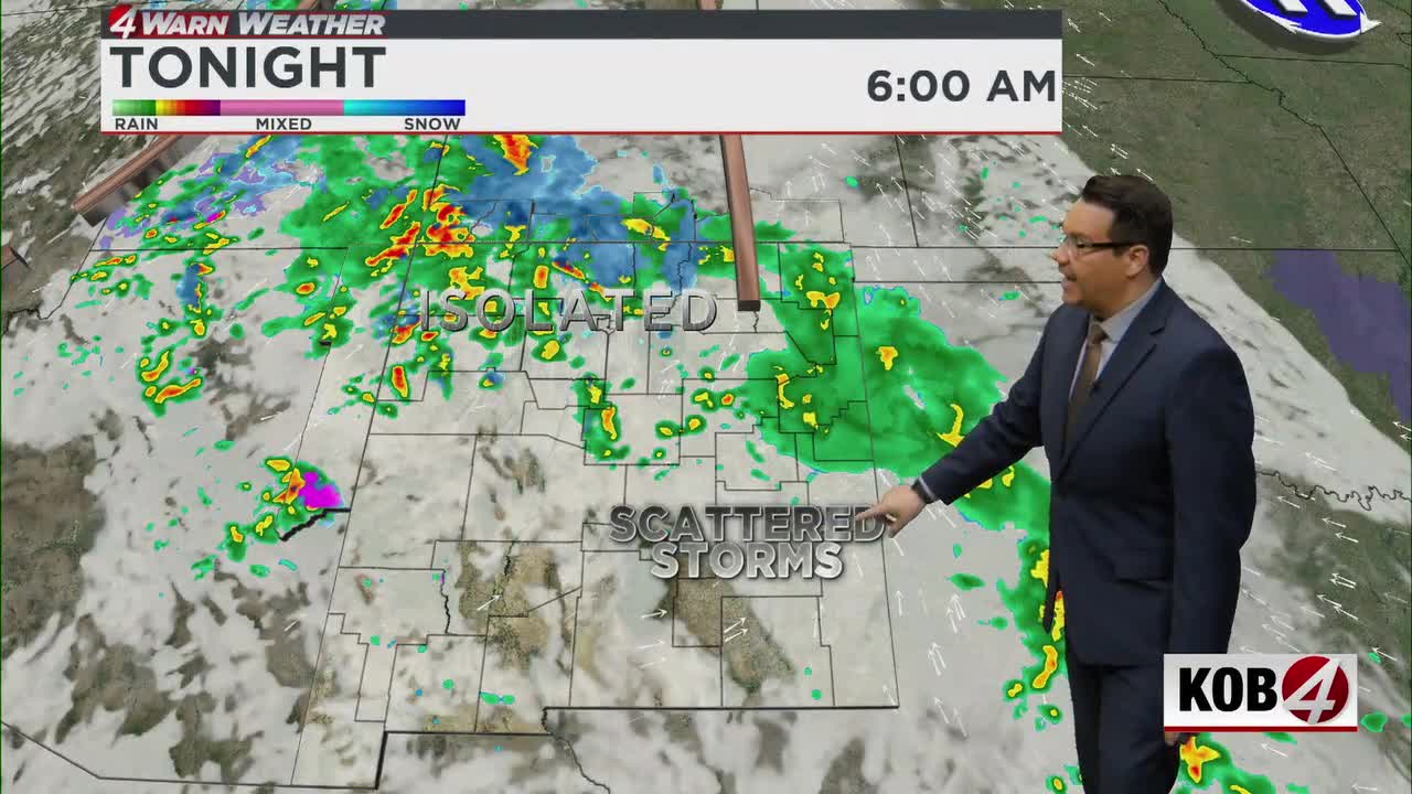
The better rain chances Friday night will move into southeastern New Mexico, while Albuquerque could see some light rain as showers move from southwestern New Mexico through central parts of the state.
There is a low risk for flash flooding around the Ruidoso burn scars. Showers and thunderstorms should move fairly quickly, which should limit how long heavy rain stays over one location.
Any heavier downpour directly over a burn scar still needs close watching, even though the overall flooding threat remains low.
Overnight, the first disturbance will keep moving east and rain will decrease across central New Mexico. Showers and a few embedded thunderstorms will continue across south-central and southeastern New Mexico into early Saturday morning.
What changes Saturday?
By Saturday morning, scattered showers will begin developing across northwestern New Mexico, north-central New Mexico, the Four Corners and the northern mountains. The activity should become more numerous by late morning.
On Saturday, a stronger Pacific disturbance will move across the Four Corners. Rain showers will become scattered to numerous across much of northern New Mexico, with the better chances along and north of Interstate 40.
That includes Farmington, Shiprock, Gallup, Chama, Taos, Los Alamos, Santa Fe and the northern mountains. The Albuquerque metro will sit near the southern edge of the better shower coverage, with a few showers possible.
Breezy west winds will develop behind the system, with the stronger winds generally along and south of Interstate 40. That will add a chilly feel to the day, especially where clouds and showers are present.
Rain and snow outlook
Lower-elevation locations along and north of Interstate 40 will generally receive up to one-quarter inch of rain. The northern mountains could receive more, with west and southwest-facing slopes picking up one-quarter to three-quarters of an inch of liquid precipitation.
Northwestern New Mexico still faces some concerns because the ground remains saturated from flooding events in late October. Some roads and recovery areas are still muddy and difficult to access, though the chance of new flooding or recovery impacts remains low at around 10 to 20 percent.
Snow will develop across the highest northern mountains, especially in the Tusas Mountains, Chama, higher terrain near the Colorado border and the higher peaks of the Sangre de Cristo Mountains.
A winter weather advisory is in effect from midnight through 9 p.m. Saturday for the Tusas Mountains. The main concern will be winter travel along U.S. Highway 64 through the Tusas Mountains, where snow could create slick roads, reduced traction and periods of lower visibility.
Saturday night will turn colder, with low clouds moving into eastern New Mexico and patchy fog or freezing fog possible in western valleys.
- For Related Stories: Eddie Garcia Weather Forecasts