A WINDY & variable day under mostly/partly sunny skies across Nebraska! High temperatures statewide ranging from 64° – 83° with dew points in the 50s->60s!
NW->S winds will gust to near 20-30+ mph across much of Nebraska today!
FRIDAY MORNING (12am-9am): Rain & T-storms develop in SE Nebraska. Best rain chances from Columbus->Kearney & areas east.
Your Friday morning commute could consist of a few isolated showers & T-storms. Rain moves out by 10am Friday.
Friday night will bring T-storms across E Nebraska with lighter rain farther west.
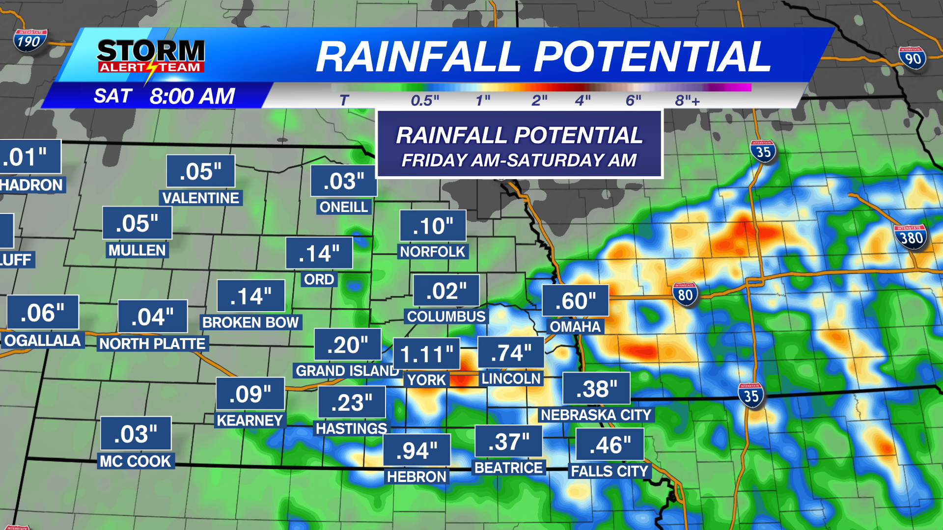
Rainfall through Saturday morning: SE Nebraska could see 0.5″-1.0″+ FRI-SAT AM. Farther west will see lighter rain/drizzle.
NEXT MONDAY-TUESDAY: Watching for our next big chance for rain, storms & colder air across Nebraska. Stay tuned for the latest!
High temperatures look to stay near 55° – 68° through the next 10 days! *Morning temperatures look to cool near 33° – 50°! The BEST RAIN CHANCE arrives Friday-Saturday morning, Monday & Tuesday. Much cooler air settles in late next week after the storm systems move out!
Tags: #klkntv, Beatrice, channel 8 weather, cool, dense fog, Fall, forecast, Grand Island, Hastings, lincoln, McCook, Nebraska, North Platte, Omaha, rain, thunderstorms, warm, weather, Wind