
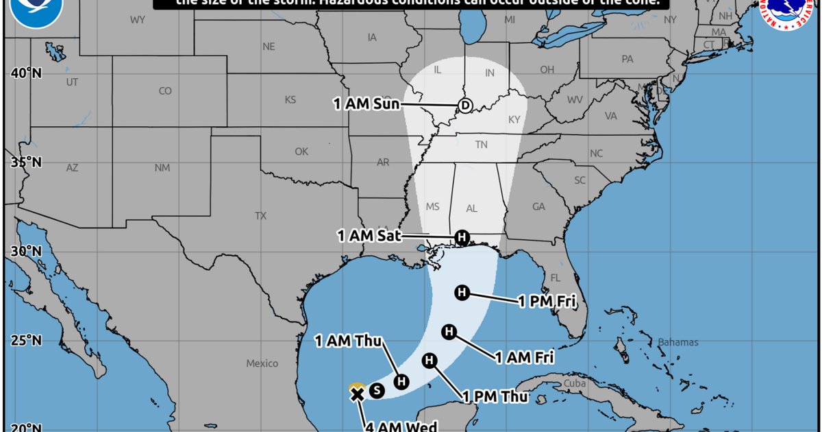
Tropical Storm Isaias has formed in the southwestern Gulf of Mexico and is expected to be a Category 2 hurricane when it makes landfall later this week, forecasters with the National Hurricane Center said in it’s 4 a.m. update Wednesday.
The storm has maximum winds of 40 mph and was moving east northeast at 8 mph.
Isaias is expected to meander east in the Gulf before taking a northeasterly turn and will likely rapidly intensify, according to the NHC. The storm is expected to make landfall early Saturday morning as a hurricane with winds of 105 mph.
The “cone of uncertainty” track for Isaias shifted east Wednesday morning, with a project landfall near the Alabama-Florida line.
However, the storm could bring heavy rain, flash flooding and other life-threatening effects to the Gulf Coast region from southeast Louisiana to the Florida panhandle. Louisiana residents should continue monitoring Isaias as the storm makes its way through the Gulf.
Check back for more on this developing story.