Jakarta, IO – Wildfire in West Kalimantan have started to dissipates, prompting the Forestry Ministry (Kemenhut) and joint task forces to reinforce control operations across six priority provinces.
According to Kemenhut’s SiPongi fire monitoring platform—utilizing data from NASA’s Terra/Aqua, SNPP, and NOAA-20 satellites—a total of 569 high-confidence hotspots were detected nationwide as of Thursday 9.05pm WIB, up from 395 the previous day.
High-confidence hotspots across the six priority provinces were distributed as follows: Central Kalimantan (96), West Kalimantan (39), South Sumatra (34), Riau (18), South Kalimantan (9), and Jambi (2).
The most dramatic drop occurred in West Kalimantan, where the number of hotspots plunged from 134 to 39. Meanwhile, Central Kalimantan remains the worst impacted priority area, triggering intensified ground checks, patrols, fire suppression, and aerial support operations.
Kemenhut emphasized that hotspots represent surface temperature anomalies detected by satellites and do not automatically confirm active fires, as a single fire event can register multiple hotspots. Every indication requires field verification.
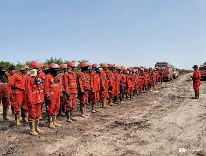
Manggala Agni—Kemenhut’s forest firefighting brigade—alongside the Indonesian Armed Forces (TNI), Indonesian Police (Polri), National Disaster Mitigation Agency (BNPB), Meteorology, Climatology and Geophysics Agency (BMKG), local governments, communities, businesses, and other stakeholders, continue conducting direct suppression, fireline trenching, mopping up, and cooling operations in vulnerable areas.
The government has also stationed 53 aerial units to support operations in Riau, Jambi, South Sumatra, South Kalimantan, Central Kalimantan, and West Kalimantan. Out of these, 34 aircraft are deployed for water bombing, while 19 handle aerial patrols and weather modification operations to harness suitable clouds for land re-wetting.
Read More: Missing Journalists: Prabowo Directs Navy Chief to Launch Search Operations
Special attention is being directed toward peatland ecosystems, where underground embers can persist even after surface flames are extinguished. Air quality monitoring shows most of Indonesia maintains good to moderate conditions. However, parts of Sumatra and Kalimantan report unhealthy to very unhealthy air quality, with some areas in Kalimantan reaching hazardous levels.
BMKG aviation meteorological observations on Thursday 10am WIB indicated that smoke continues to restrict visibility in several priority zones. Pontianak remains hazy with a visibility of roughly 1.2 kilometers, compared to about 3 kilometers in Palangkaraya, and 2 kilometers in Jambi.
Conversely, Pekanbaru and Palembang reported clearer conditions with visibilities of 6 kilometers and 10 kilometers or more, respectively. In Banjarmasin, visibility reached 10 kilometers or more by 11am WITA.
Kemenhut urges the public to refrain from land clearing via burning and to promptly report any sightings of smoke or fire for early intervention. (des)