INDIANAPOLIS (WISH) — More rain & storms are expected Friday night into Saturday and some severe weather remains possible. Moderate to major flooding continues. A cold front sweeps through late Sunday leading to better weather for a few days early next week.
FRIDAY EVENING/NIGHT:
Relatively quiet conditions are expected for the evening, but another batch of rain & storms is expected to roll in from the west late tonight. Some of these may contain high wind gusts and lighting. Any additional rain will add insult to injury to our flooding situation. Lows will be in the 70s and it’ll stay muggy.
SATURDAY:
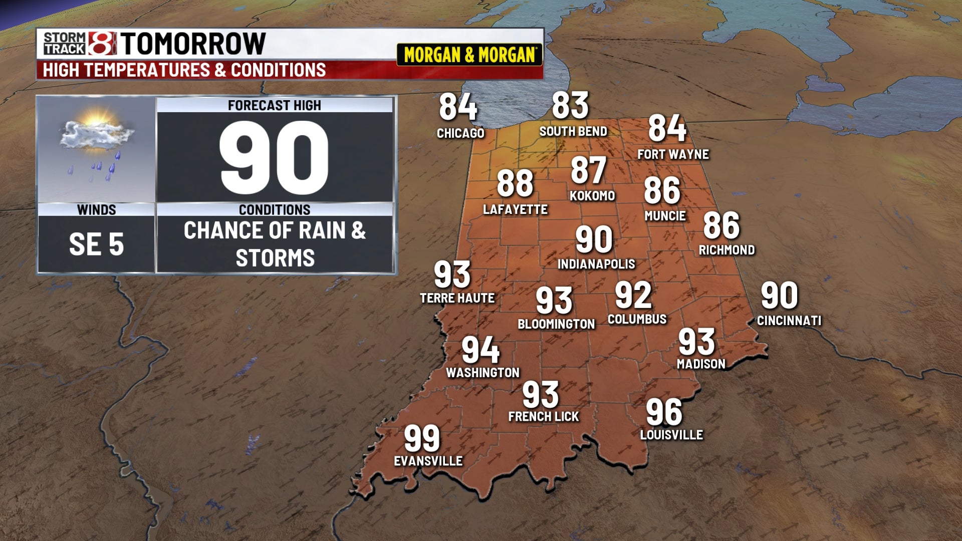
The chance of rain & storms continues. Some strong to severe storms could develop at some point as well. The temperature forecast is tricky with the early threat of rain and clouds. Afternoon highs will range from the low 80s across Northern Indiana with upper 90s down near Evansville. Heat indices across southern Indiana may be push 110..
SATURDAY NIGHT:
Partly to mostly cloudy. A few more showers & storms are possible. Muggy lows in the 70s.
SUNDAY:
Warm & humid with a chance of rain & storms. There could be a few strong storms again at some point. Temperatures will range from the mid 80s to the mid 90s across Indiana.
NEXT WEEK:
Some rain & storms could occur across Southern Indiana on Monday but many of us should be on the drier side. Tuesday looks great but another system will move through Wednesday into Thursday. The early outlook for next Friday, August 21 shows fair weather for the first evening of high school football and the Zone.