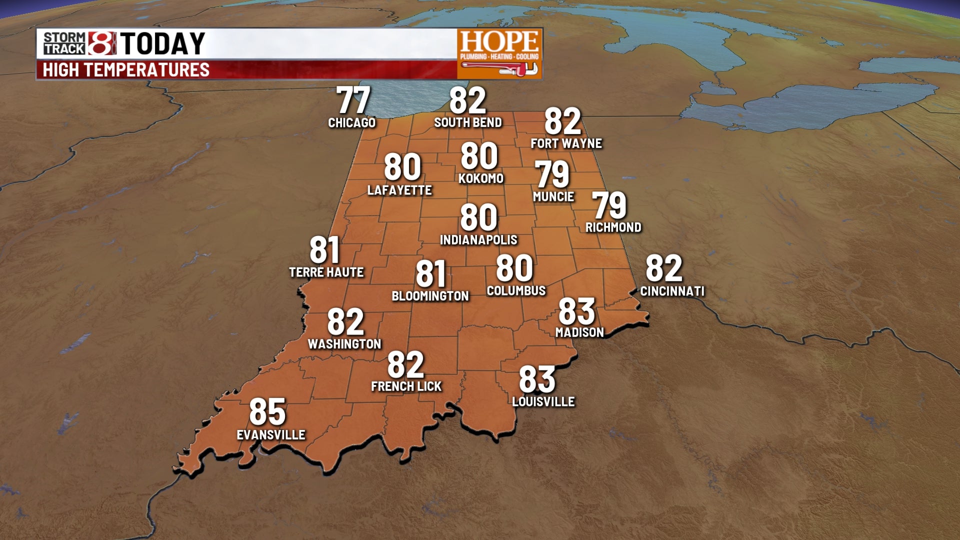
INDIANAPOLIS (WISH) — Reduced visibility this morning will give way to sunshine and dry conditions through midweek. Humidity returns late week with scattered rain chances Thursday and Friday.
This morning
Dense fog has developed across central Indiana, particularly along the I-70 corridor and in areas near bodies of water and open fields. Visibility has dropped to less than a quarter mile in some spots.
The fog will be most widespread through the morning commute, persisting until around 9 a.m. Temperatures are starting out in the mid-60s with light northeast winds.
Today
Once the fog clears by mid-morning, we’ll see plenty of sunshine across the state. High pressure centered over the Great Lakes will keep conditions dry and pleasant.
Look for highs to reach the low 80s across much of central Indiana. Northeast winds will remain light at 5 to 10 mph, keeping temperatures slightly below average for early August.
Humidity will be moderate, with dew points in the mid-60s.
Tonight
Mostly clear skies will allow temperatures to fall into the upper 50s to around 60 degrees across the state. Winds will shift to the east and become light and variable.
Dew points will drop into the mid to upper 50s, creating noticeably less humid conditions overnight. This combination of light winds and lower dew points could lead to patchy fog redeveloping late tonight, especially in areas that received heavy rain over the weekend.
Tuesday
High pressure remains in control, keeping us dry for another day. We’ll see mostly sunny skies with highs climbing into the low to mid-80s.
Wednesday
Conditions remain dry through Wednesday, though we’ll start to see humidity levels tick upward. Look for partly to mostly sunny skies with highs in the low to mid-80s.
Thursday and Friday
A frontal system will stall across the area, bringing multiple rounds of showers and thunderstorms. The heaviest rain looks to arrive Thursday afternoon and evening, particularly along and south of the I-70 corridor.
Rain chances will continue Friday with scattered showers and storms possible at any point during the day.
There is currently a low risk for severe weather, though we’ll continue to monitor for any stronger cells that could produce gusty winds or heavy downpours.
Highs both days will be in the mid to upper 80s with increasing humidity. Dew points will climb into the upper 60s to lower 70s, making it feel muggy.
Weekend and beyond
Scattered rain chances will linger into Saturday before we start to dry out Sunday. A ridge of high pressure may build into the area early next week, which would lower rain chances and allow temperatures to warm into the upper 80s to near 90 degrees.
For now, expect partly to mostly cloudy skies over the weekend with highs in the mid-80s and a continued chance for scattered showers and storms.
7-day forecast
The pattern remains active through the upcoming week. We’ll enjoy dry conditions Monday through Wednesday with highs in the low to mid-80s before rain returns Thursday and Friday. The weekend brings a gradual decrease in rain chances, with drier and warmer weather possible early next week.