A WINDY, warm, sunny & dry day across Nebraska. High temperatures reaching the 80s & 90s with sustained winds between 20-25 mph & peak gusts near 40-50 mph.
High temperatures will range from the upper 70s farther NW and upper 80s farther south. A cold front will swing through by the afternoon bringing the winds & “cooler air”.
Peak wind gusts Wednesday afternoon will reach 40-50 mph, with the strongest winds expected in northeast & SE Nebraska where WIND ADVISORIES are in place.
Father’s Day Weekend SEVERE WX:
Best threat for severe weather looks to be from SW Nebraska & along the NE/KS line. Storms will form out west Saturday afternoon, carrying a hail/wind threat. By late Saturday into early Sunday, storms will move ESE along & near I-80, carrying all hazards including a brief tornado threat.
The LLJ will be primed near the NE/KS border, meaning better winds/rotation for storms to strengthen & progress into the night. *NW-ESE motion*
The strongest storms look to occur across SW Nebraska->east Saturday evening into the night time hours.
Rainfall potential through Sunday morning could look like this: Areas of flooding will likely occur due to the amount of moisture & rain in the atmosphere.
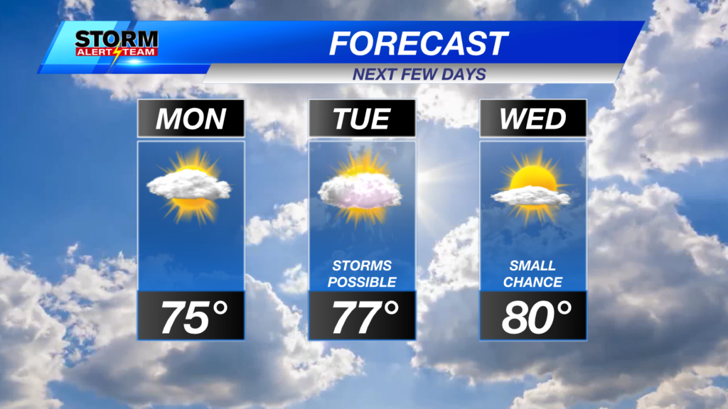
Windy and warm Wednesday. Pleasant and breezy Thursday. Friday brings more clouds & moisture. Strong to severe storms Saturday-Sunday NW->SE. Next week looks to be the same story!
Meteorologist Houston Hall
Facebook: HHallWX
YouTube: HHallWX
Tags: #klkntv, Beatrice, channel 8 weather, forecast, Grand Island, Hastings, High winds, hot, lincoln, McCook, Nebraska, North Platte, Omaha, rain, warm, weather, Wind, windy