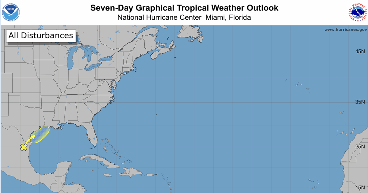
A disturbance is expected to move over northeastern Mexico and southern Texas before reemerging in the Gulf and drenching parts of southeast Louisiana this week.
The trough of low pressure has a small chance of forming into a tropical cyclone, forecasters with the National Hurricane Center said as of 7 a.m. Monday. The disturbance could approach western and central Louisiana and contribute to heavy rain and flooding near the end of the week and going into the weekend for the southeastern portion of the state.
NHC forecasters said the system has a 20% chance of forming in the next 48 hours and a 30% chance of forming in the next seven days.
The storm produced disorganized showers and thunderstorms Monday morning as it continued its drift northward. It is not expected to develop further as the trough moves inland through Mexico and Texas for Monday and most of Tuesday.
By late Tuesday or Wednesday, the trough is forecast to move northeast into the Gulf of Mexico, NHC forecaster Larry Kelly said. By midweek, the trough could experience conditions in the Gulf that would help it further develop.
Regardless of whether the disturbance forms, some portions of Louisiana and eastern and southern Texas should expect heavy rain, flash flooding and gusty winds from late Wednesday through the rest of the week.
In the New Orleans, Baton Rouge and Acadiana area, heavy rains and flooding are expected through the week into the weekend due to a separate ridge over the central gulf. The disturbance could start contributing to rainfall later this week, according to the National Weather Service.
This system is the first tracked disturbance of the 2026 Atlantic hurricane season, which began on June 1. Researchers forecasted below-average activity this year for the first time in over a decade due to the expected effects of El Niño.