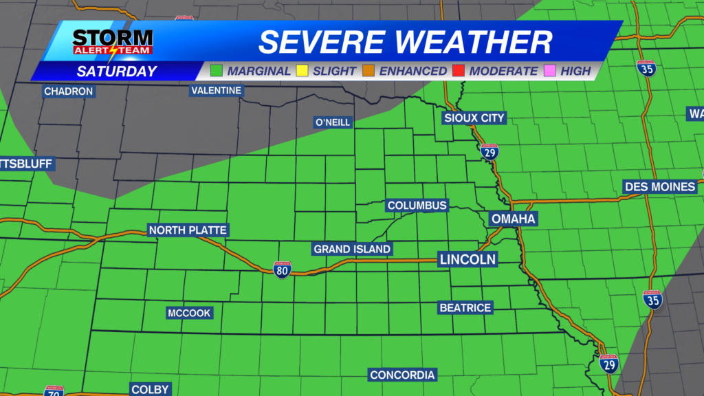
There is a MARGINAL risk for severe weather this evening. This is mainly due to the afternoon & evening storms that could have the potential for large hail, gusty winds and an isolated tornado. Storms this evening will depend on how fast clouds move out this morning. Stay tuned for updates.
The 2% tornado risk lays in SE Nebraska. Strong moisture, energy, wind shear and low level jet winds will all be peaking this evening. This will make for the best environment for spin in the atmosphere. 4-8pm.
Near 4-8pm, if there is any ample sunshine near SE Nebraska, this will be the time that storms will begin to show up and see if they can hold together as they move north from Kansas. This will be the peak tornado potential!
8-11pm will be the main time to watch for multiple strong to severe storms. Any single storm will likely become severe this evening, with large hail and gusty winds.
STORM TIMELINE Saturday:
By 2-4pm Saturday, areas along and east of I-80 could see a few strong to severe storms. If storms break the CAP, they will have the best potential to grow fast & become severe.
5-11pm near and after sunset, isolated storms will try and become severe with the best chance for a brief spin up in SE Nebraska.
Near 3-7pm, CAPE values or storm energy will be greatest over SE Nebraska where that tornado risk is in place.
A LOT of moisture will move in Saturday afternoon across eastern Nebraska! It will feel muggy today through Sunday with dew points in the 60s & even 70s. This will also try and help fuel storms by the afternoon.
Afternoon highs will be in the 60s and 70s for most of us. We’ll see quite a bit of clouds through the afternoon. These clouds will determine hoe storm development plays out this evening.
Meteorologist Houston Hall
Facebook: HHallWX
YouTube: HHallWX
Tags: #klkntv, Beatrice, breezy, channel 8 weather, cool, forecast, Grand Island, hail, Hastings, hebron, lincoln, McCook, Nebraska, North Platte, Omaha, rain, severe weather, Spring, thunderstorms, tornado, warm, weather, Wind