HIGH WIND Alerts are in place through Friday morning. Wind gusts between 55-75 mph will be likely through 4am Friday. Critical fire weather will be a concern for all of Nebraska.
Strong SW winds will gust to near 40-45+ mph all day Thursday. Winds will continue into the overnight across eastern Nebraska.
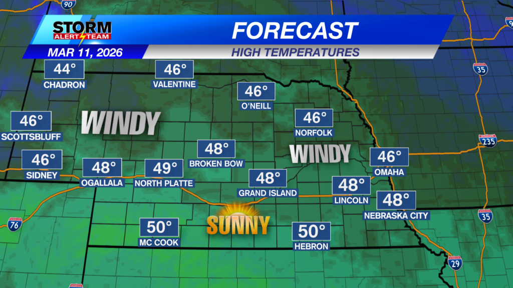
Today will be a warm & WINDY day across Nebraska! SW winds will gust to near 75 mph in the sandhills, while much of us getting gusts near 45-55+ mph. Temperatures will warm up nicely into the 60s & 70s under mostly sunny skies.
Temperatures will be well above average in SE Nebraska this afternoon! Temperatures near 67-76 degrees under mostly sunny skies with those gusty SW winds.
SUNDAY: A GREAT day to stay inside Sunday! BLUSTERY conditions, rain & snow all possible through Sunday night. Rain will develop farther south Sunday morning with blowing snow occuring by Sunday afternoon & evening. Snow totals most likely near 1-3″+. Stay tuned for the latest.
Thursday will be warm, sunny and very windy. Friday will be chilly due to a cold front late Thursday. Saturday night into Sunday, a potent cold front moves through bringing increased chances for rain/snow across northeast & eastern Nebraska. Sunday and Monday are great days to stay inside. Late next week, temperatures could reach the low to mid 80s with limitid precipitation chances.
Meteorologist Houston Hall
Facebook: HHallWX
YouTube: HHallWX
Tags: #klkntv, Beatrice, breezy, channel 8 weather, fire weather, forecast, Grand Island, Hastings, High Wind Warning, lincoln, McCook, Nebraska, North Platte, Omaha, rain, red flag warning, snow, Spring, warm, weather, Wind