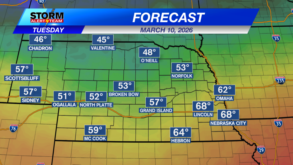
After a lot of 70s and 80s on Monday, we cool down a little bit for Tuesday. It’ll still be above average for most of the southern half of the state, but it’ll be quite a bit cooler than Monday was.
A cold front is going to be slicing across the northern half of Nebraska late Tuesday into very early Wednesday and that’s going to bring us a chance for some precipitation. Snow to the north, rain further south.
North central Nebraska may see some minor snow accumulations, but most of us will see a light rain/snow mix. It doesn’t look like it’ll be a lot of moisture, but we’ll take what we can get.
High temperatures on Wednesday will be closer to normal with a lot of upper 40s and low to mid 50s out there.
After a cooler Wednesday, we warm right back up. Near 70 on Thursday and near 60 on Friday. We cool back down by Sunday!
Chief Meteorologist Rusty Dawkins
Facebook: RustyWx
YouTube: RustyWx
TikTok: RustyWx
BlueSky: RustyWx
Instagram: RustyWx
Threads: RustyWx
Twitter: RustyWx
Categories: Channel 8 Eyewitness News Weather, Forecast
Tags: Beatrice, Broken Bow, channel-8-eyewitness-news-weather, Columbus, Crete, Fairbury, forecast, Grand Island, Hastings, Kearney, lincoln, lincoln forecast, Lincoln weather, McCook, Nebraska, nebraska weather, Ord, seward, southeast nebraska, weather, york