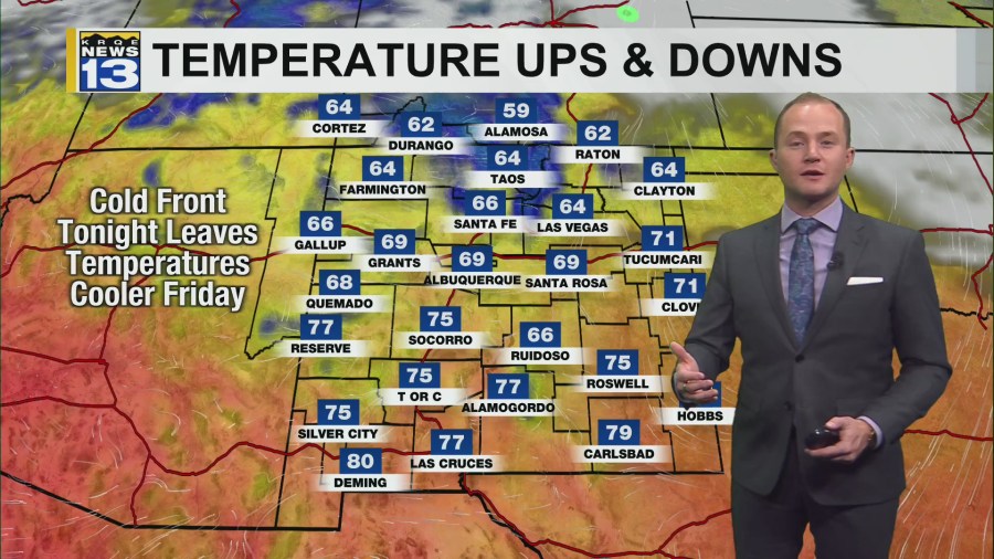
A cold front will move through New Mexico tonight, slightly cooling down temperatures Friday. Above average temperatures continue into Saturday before a stronger cold front moves in Saturday night.
The wind has picked up today around the northern mountains and in northeast/east-central New Mexico. A few wind gusts have been as high as 40 mph. The westerly wind has also warmed up temperatures in eastern New Mexico, as the whole state continues to hold onto well-above average high temperatures. Winds will die down tonight as a Pacific cold front moves across the state. The cold front will leave high temperatures a few degrees cooler, but still above average Friday. High temperatures stay above average Saturday.
A strong backdoor cold front will move into New Mexico from the northeast Saturday. It will start cooling temperatures down Saturday afternoon in eastern New Mexico, but the biggest drop in temperatures will be Saturday night into Sunday. Highs on Sunday will be as much as 25º cooler across the state, bringing high temperatures back down to near average for the western half of the state and below average across eastern New Mexico. The cool down is short lived though with highs climbing back above average again next week. No rain or precipitation is forecast anywhere in New Mexico for the next week.