INDIANAPOLIS (WISH) – Another hot and dry day today but we do have a pattern change which will bring in some much needed rain across parts of the state. We will see temperatures very close to record values today but they do drop back into the normal territory as we head into the first full day of fall.
The newest drought monitor came out yesterday and most spots across parts of Indiana are under a moderate drought right now. We are running more than an inch below normal for the month of September in Indianapolis but almost 2 in below normal since August 1st.
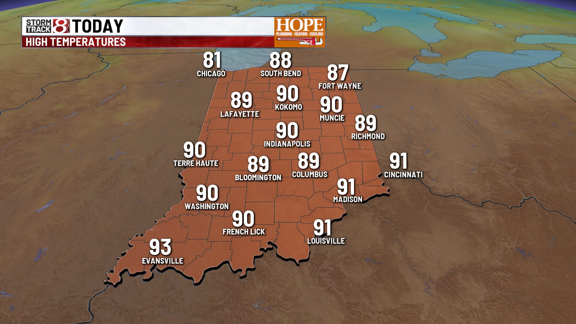
TODAY: No rain anticipated today, lots of sunshine expected. We will look for high temperatures into the upper 80s near 90 degrees. The normal high temperature for this time of year is 77 and the record is 93.
TONIGHT: Partly to mostly cloudy skies expected throughout the night tonight. If you are heading to those high school football games we will see dry conditions with a little bit more cloud cover and it is going to be toasty at kickoff. Temperatures will be into the mid and upper 80s. Overnight temperatures fall close to 65 degrees.
TOMORROW: Look for a partly cloudy sky on your Saturday a few spotty showers and thunderstorms will be possible. High temperatures will be climbing into the mid and upper ’80s.
7 DAY EXTENDED FORECAST: Partly cloudy skies on Sunday a better chance for some scattered showers and even a few thunderstorms possible as well. High temperatures will climb into the mid ’80s.
Fall officially begins on Monday. We’ll look for mostly cloudy skies with some scattered showers and thunderstorms possible. High temperatures will be into the lower ’80s. Upper 70s near 80 on Tuesday and Wednesday with more scattered rain showers possible