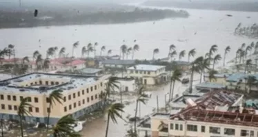
A tropical wave, combined with the effects of a trough, will cause moderate to heavy downpours today, with thunderstorms and gusty winds in María Trinidad Sánchez, Samaná, Hato Mayor, La Altagracia, La Romana, El Seibo, San Pedro de Macorís, Monte Plata, Sánchez Ramírez, and Santo Domingo.
The Dominican Institute of Meteorology (Indomet) also reported that the rains will affect San Cristóbal, San José de Ocoa, Santiago, La Vega, Duarte, Monseñor Nouel, Azua, Elías Piña, Dajabón, Independencia, and Bahoruco. It will occur in the morning and afternoon.
For the National District, the agency that oversees weather conditions predicted increased cloudiness at times with isolated showers.
The weather forecast predicts hot temperatures, with a minimum bof21°C ato23°C and a maximum bof31°C ato 33 °C
On both the Caribbean and Atlantic coasts, Indomet recommends that operators of fragile, small, and medium-sized vessels navigate with caution near the coastal perimeter without venturing out to sea, due to abnormal winds and waves.
Extended forecast
For tomorrow, Sunday, Indomet predicts that the influence of the trough and the tropical wave will maintain very favorable weather conditions, so that from early hours there will be downpours and thunderstorms in towns located on the southern coast of the country.
COE maintains alert in 19 provinces
The Emergency Operations Center (COE) maintains 19 provinces under alert due to the risk of urban and rural flooding, overflowing rivers, streams, and ravines, as well as landslides, particularly in vulnerable areas.
San José de Ocoa remains on red alert, Pedravia and Monte Plata are on yellow alert, while Independencia, Pedernales, Bahoruco, Barahona, San Juan, Azua, San Cristóbal, Puerto Plata, Santiago, Monseñor Nouel, Duarte, San Pedro de Macorís, La Romana, La Altagracia, Santo Domingo, and the National District are on green alert.